Editorial Note: This post was written by Grace Erny, one of the BEARS intensive survey directors.
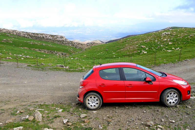
The first time I worked on an archaeological survey in Greece (or anywhere), it was May of 2014. I was 23 years old and had just finished an MA at the University of Colorado. I had also spent many anxious hours over the winter and spring trying to learn how to operate a stick shift on the snowy hills of Boulder in anticipation of driving a Fiat Panda full of undergraduate field school students around the Peloponnesian countryside (thank you to Professor Sarah James and my colleague Alyssa Friedman for sacrificing their cars to this noble cause – their clutches probably still haven’t recovered!)
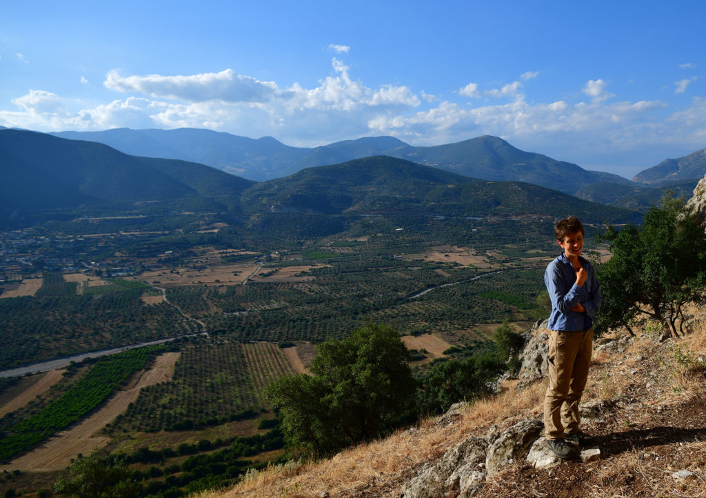
This project was WARP, or the Western Argolid Regional Project, an intensive surface survey of the Inachos River Valley in the northeast Peloponnese (just a short drive inland from Argos and Nauplio). After three summers of fieldwork and three more summers of study in the apotheke, the final publication for WARP is underway – I’m hoping to finish drafts of my contributions to the volume this summer. WARP was my introduction to Mediterranean survey, and I really can’t imagine a better one. Our directors (Bill Caraher, Scott Gallimore, Sarah James, and Dimitri Nakassis) gave us a packet of classic Mediterranean survey readings at the beginning of the summer, including Cherry’s “Frogs Round the Pond;” Bintliff, Howard, and Snodgrass’ “Hidden Landscapes of Prehistoric Greece;” and Pettegrew’s “Chasing the Classical Farmstead.” Reading this stuff, together with hours of traipsing around olive and citrus groves documenting terrace walls and surface scatters, introduced me to new ways of archaeological thinking and shaped the dissertation I’m writing now. My time on WARP also marked the beginning of close friendships that have lasted to this day (I’d be remiss not to mention that my fellow WARP veterans Joey Frankl, Melanie Godsey, and Dimitri Nakassis are all part of the BEARS team as well!)
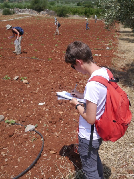
WARP used an intensive survey method common on Anglo-American projects in mainland Greece. Each day, we sent out mapping teams to divide the landscape into survey units that were as internally homogeneous as possible in terms of vegetation, surface visibility, and slope. Field walkers then lined up 10 meters apart, orienteering compasses in hand, and walked each unit in parallel lines, collecting any artifacts within a meter of their transect on either side. The team leader (this was my job) came behind them, documenting artifact counts and taking notes on a field form.
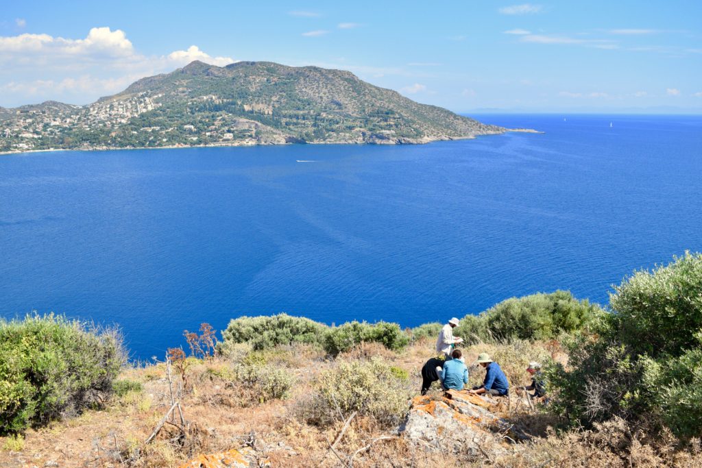
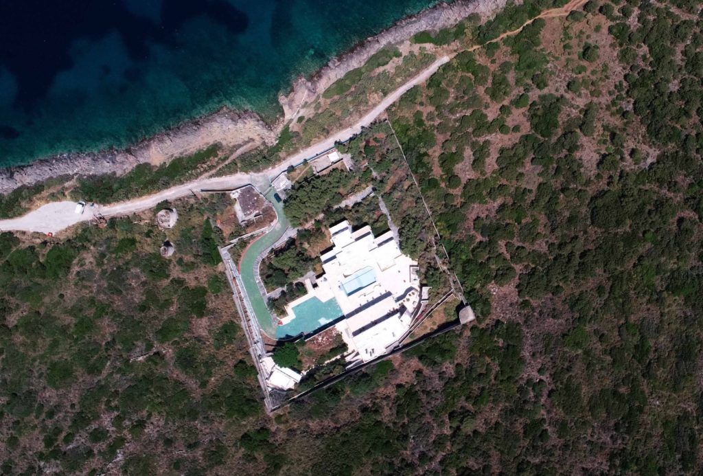
When director Sarah Murray asked me to work on BEARS, a project with an equally excellent acronym, I was excited to embark on the next chapter of my survey career. Every new archaeological project is a learning experience, but the two landscapes studied by WARP and BEARS are about as different as one could imagine. Porto Raphti, the BEARS home base, is a bustling seaside town, with a year-round population of ten thousand that swells severalfold in the summer. It faces a bay dotted with uninhabited islands, and the Koroni peninsula that juts into the south part of the bay is largely undeveloped (though a spooky abandoned walled compound, complete with adjacent windmill, at Koroni’s north tip probably deserves its own blog post).
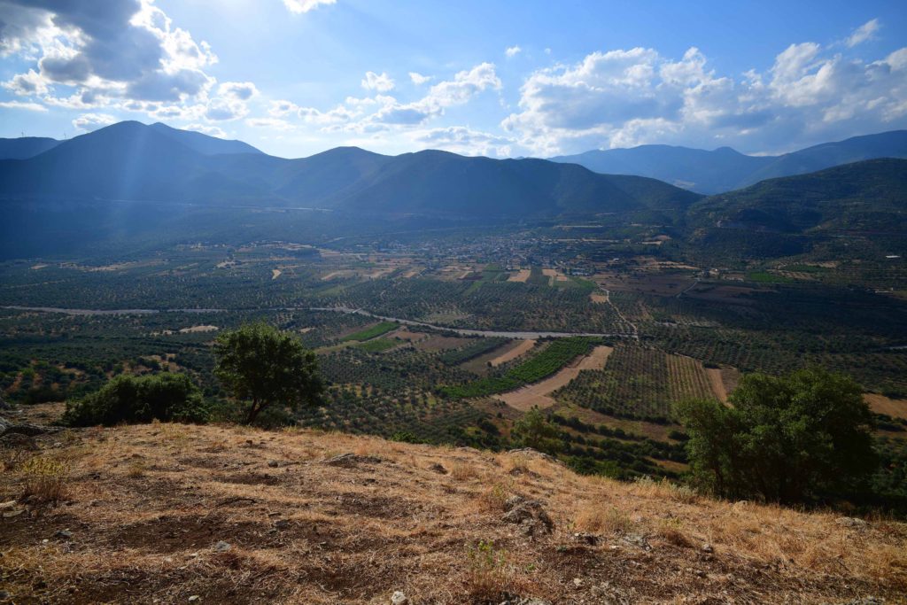
Though parts of the BEARS survey area have been cultivated at various times in the past, agriculture and pastoralism have been minimal in recent years across much of the BEARS territory. WARP’s inland survey area forms quite a contrast to this. Though a handful of villages dot the Inachos Valley, much of the valley floor is taken up with crops like citrus, stonefruit, and market garden vegetables, which require plowing and irrigation. The steeper valley slopes were often terraced, sometimes with a bulldozer, and planted with olives; parts of them were covered by thick stands of maquis, the catch-all name for the prickly green shrubs that most surveyors in Greece have gotten stuck in once or twice. Goats and sheep wandered these slopes too. We documented many a mandra, or sheepfold, and I was (rightfully) mocked several times for scribbling “fresh goat poops” on my WARP survey forms.
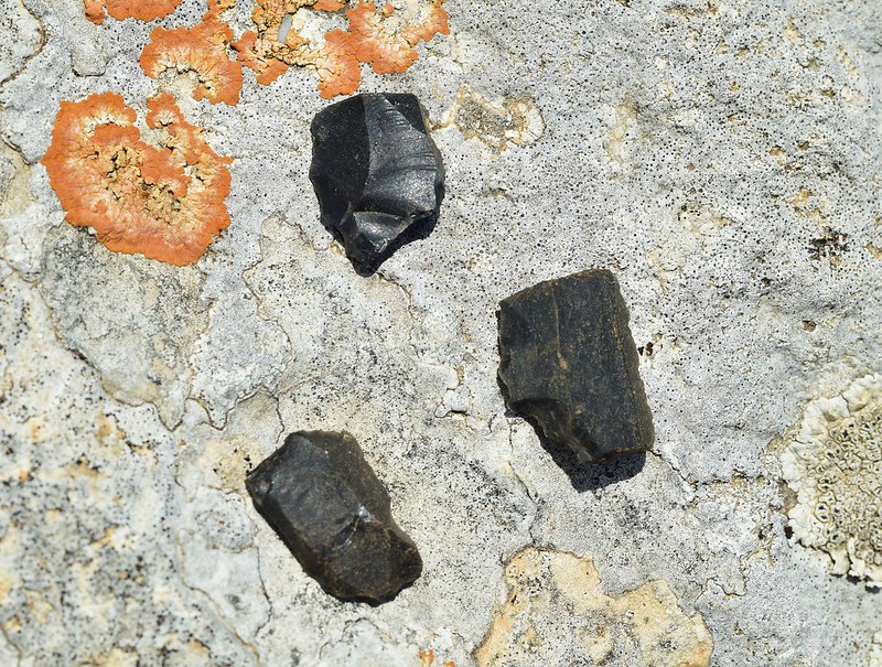
BEARS’ distinct regional environments and research goals when compared to WARP required a different set of survey methods. In 2019, the BEARS team spent most of our time collecting in 20 x 20 m grid squares in three areas that were known to be of interest from previous excavations (the Koroni acropolis) or extensive survey (Raphtis island and Pounta). This higher-resolution collection strategy was necessary chiefly because the most striking difference between BEARS and WARP (or really BEARS and any other survey project I’ve ever heard of!) was the sheer quantity of artifacts on the surface. I’m sure that all first-time surveyors on BEARS got very sick of my colleague Maeve and I shaking our heads and warning them that the BEARS artifact-palooza isn’t what most survey is really like. In 2019, I split most of my BEARS time between Raphtis island and the Pounta peninsula, a flat spit of land extending out into the bay. In three seasons of fieldwalking across WARP’s 30 square kilometer survey area, our team recovered 161 pieces of chipstone in total. In just forty-five 20 m x 20 m grid squares on Pounta, we collected over seven thousand lithics – mostly obsidian, but with a handful of chert and quartz for good measure. Lithics can be tricky to spot for a new surveyor, but Pounta was a veritable crash course in lithics detection. Within five minutes of survey on Pounta, I had seen more obsidian lithics in the wild than I had over my entire archaeological career of survey and excavation combined (including a year of full-time excavation in the Mesa Verde region of the Southwest U.S., a reasonably obsidian-rich area). On some of the hottest days of our 2019 season, the obsidian on Pounta would heat up in the sun, eventually burning the tips of your fingers as you picked up piece after piece. The ultimate showstopper, though, was when survey team member Kat picked up a small, bowling-pin-shaped Cycladic figurine from the surface – perhaps a tiny stowaway on an Early Bronze Age obsidian-bearing ship from Melos.
The quantity of finds from Raphtis island was equally overwhelming, to the point where teams collected only a selection of diagnostic sherds from each grid square so as not to overwhelm the apotheke (in contrast, finding a single diagnostic sherd on WARP was sometimes enough to keep a survey team excited for a couple of hours!) The preservation of BEARS sherds was also remarkable. Surface material is notorious for its abraded and worn surfaces, but much of the material from Raphtis island looked like it could have come out of an excavation trench. For me, working on these two projects was a vivid illustration of how much modern land use can affect archaeological surface material. On Raphtis island, away from the constant plowing and animal trampling, the sherds were pristine!
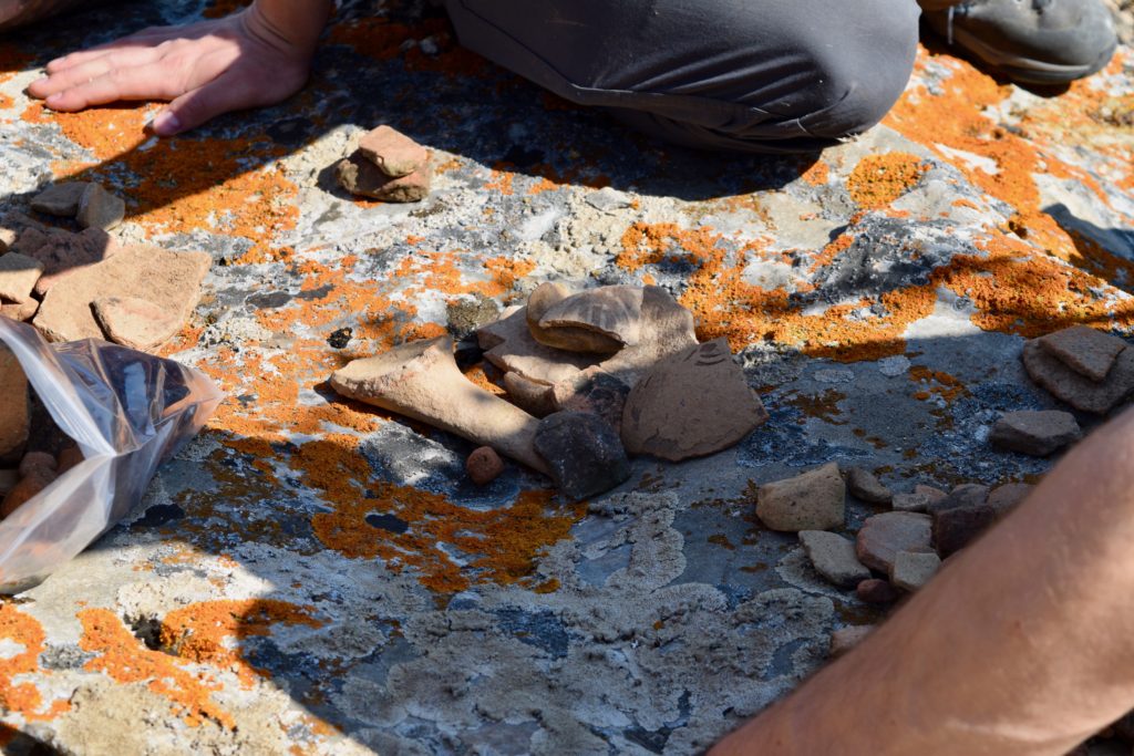
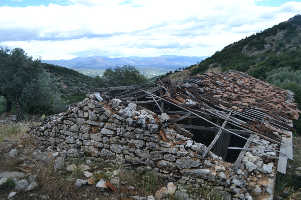
Finding so much well-preserved material on the surface has huge appeal – it’s like the archaeological equivalent of winning the jackpot, all day every day, with no digging required. Some days, though, I missed the feeling of rambling through a larger landscape rather than crawling on my hands and knees through a tiny grid square, looking for goodies. I’m responsible for writing up the Early Modern and Modern Greek material from WARP, which means that I spent a lot of time on WARP scrambling up to an Early Modern rock shelter (probably used in the Greek War of Independence) and exploring collapsing stone houses at the mostly-abandoned seasonal settlement of Chelmis (and getting caught in a memorable surprise thunderstorm along the way). Both kinds of experiences have their benefits.
WARP and BEARS are two very different projects, with strategies and goals that respond to the two very different archaeological landscapes they seek to understand. BEARS’ abundance of artifact data at a very high spatial resolution permits us to track the distribution of activities within distinct sites in a level of detail that just isn’t possible with WARP data. WARP’s data, on the other hand, will allow us to write a more continuous diachronic history of a single microregion. As I sit at home typing on my laptop during this very strange summer, I’ll certainly miss both projects quite a bit.
