Archaeological Survey After Excavation

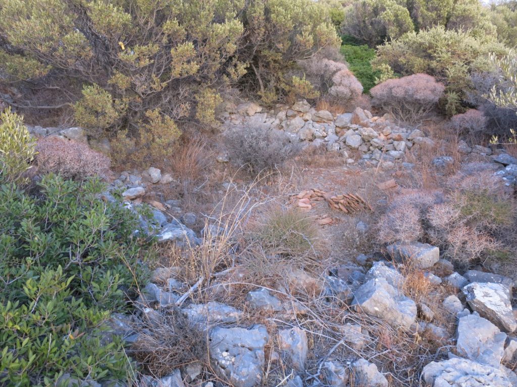
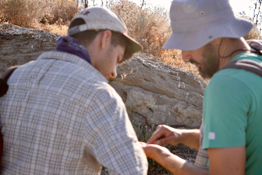
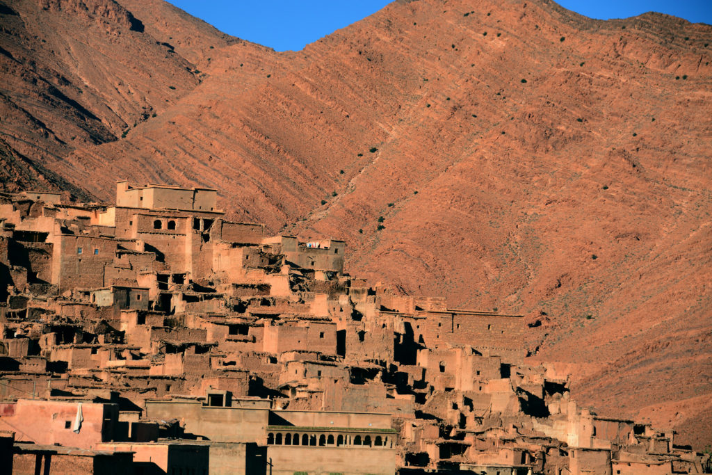
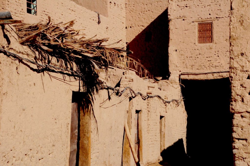
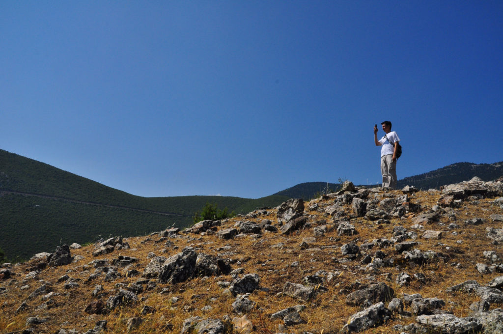
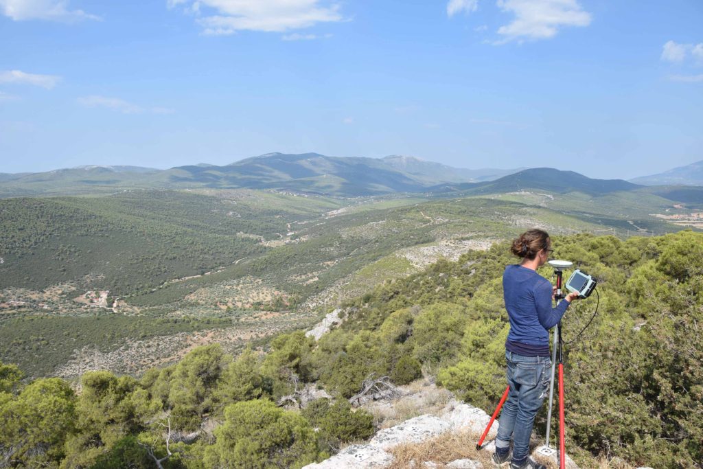
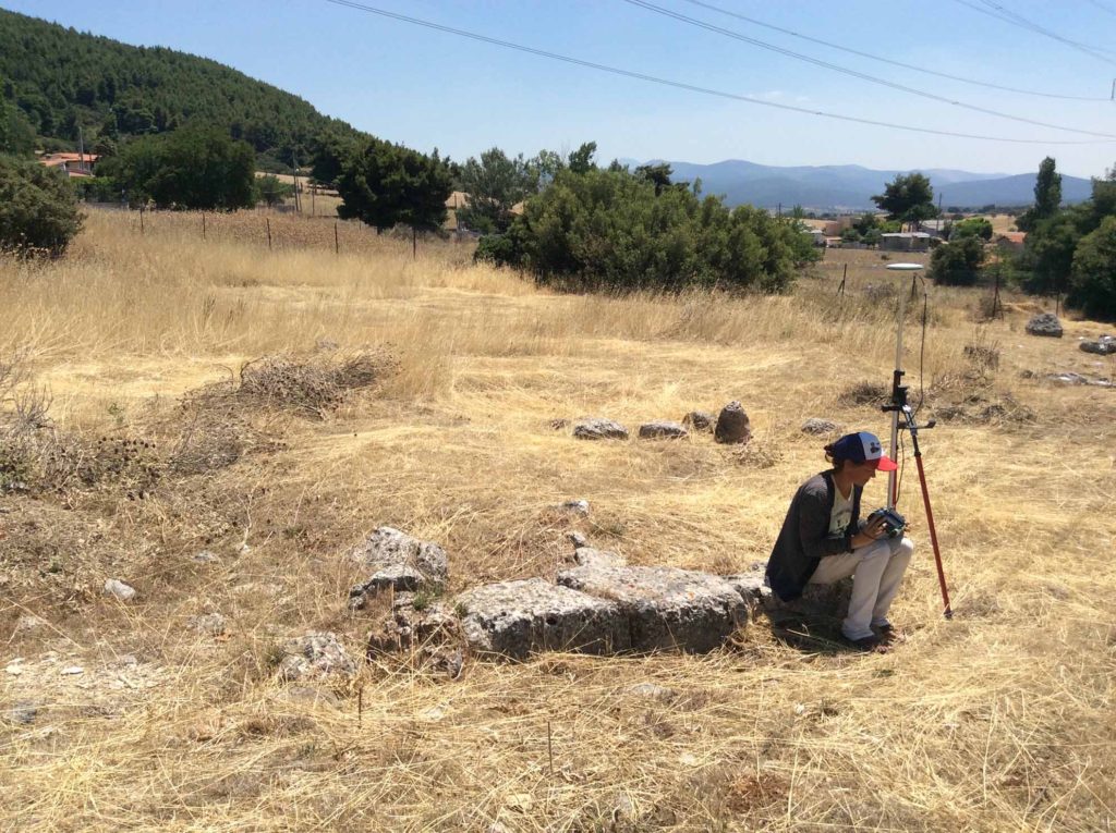
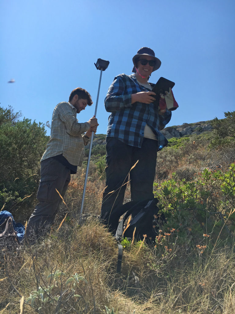
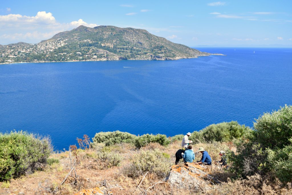
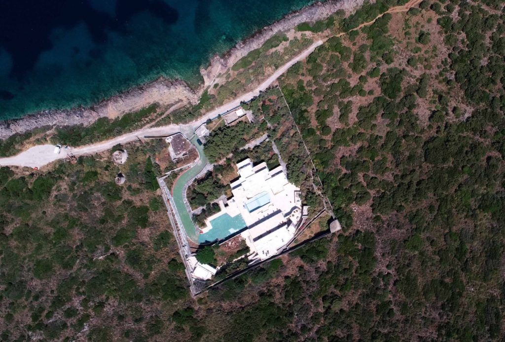
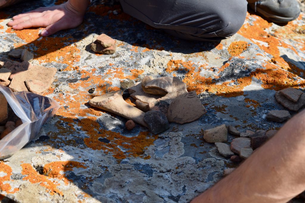
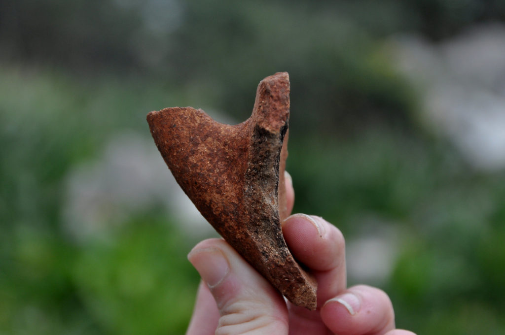
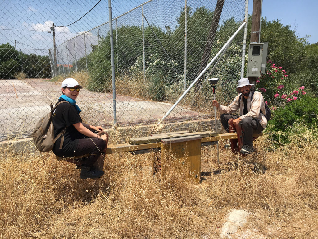
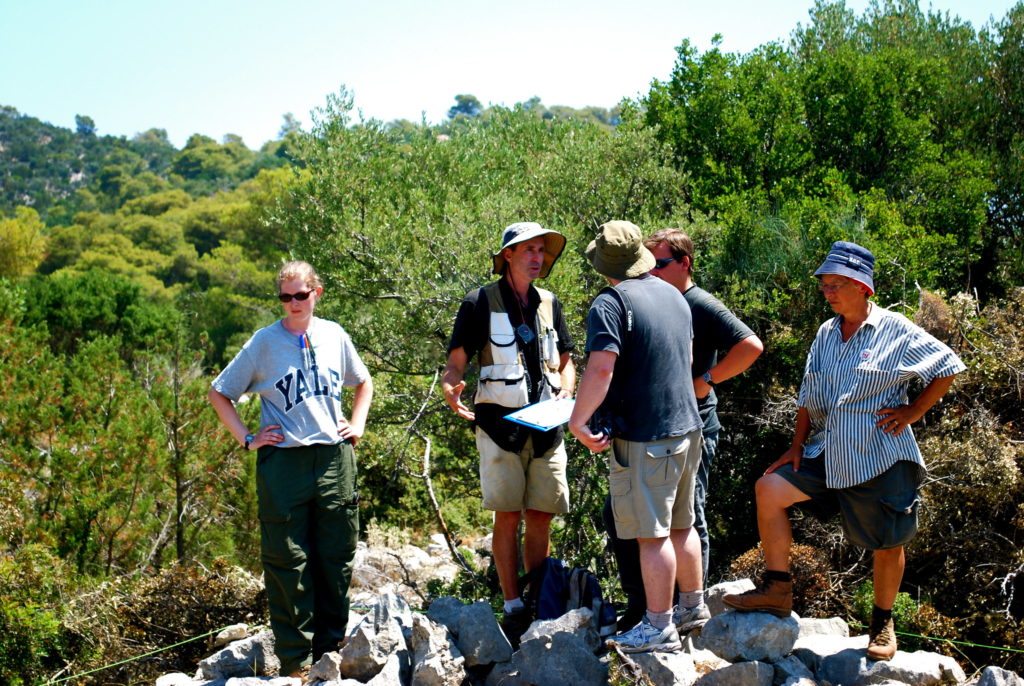
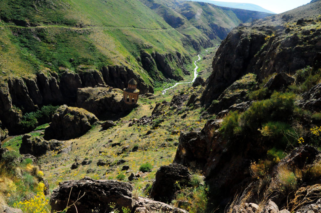
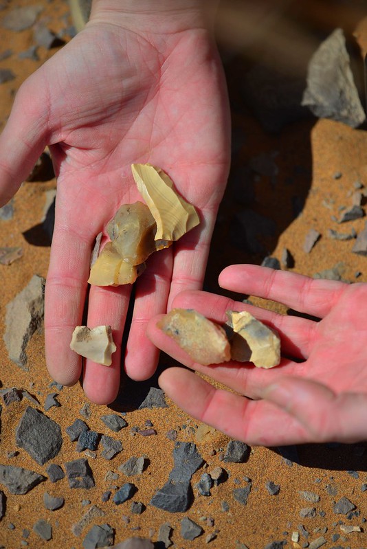
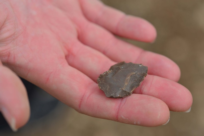
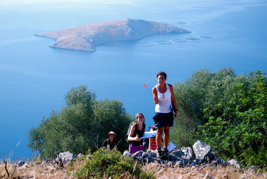
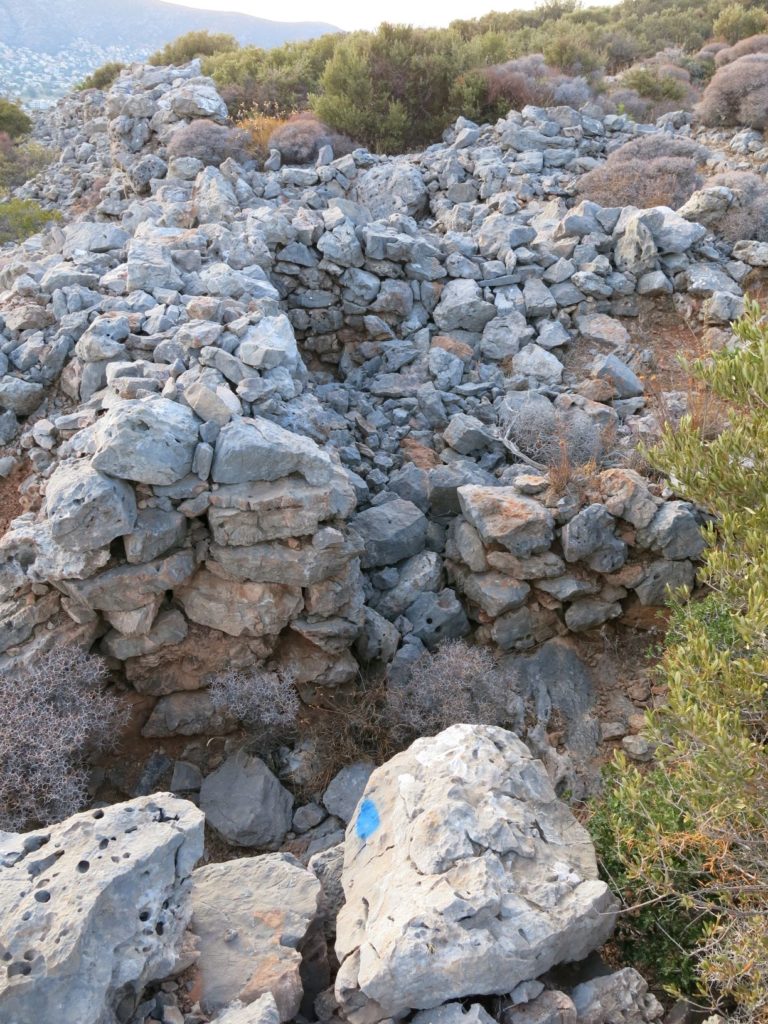
For the first two week of BEARS 2021, we’ve been working in one small team of six to tackle the previously discussed scatter on Praso isle . But thanks to some bureaucratic heroics, Maeve McHugh – leader of all things to do with Koroni fieldwork, swooped into Porto Rafti on Sunday, so we started chipping away at our Koroni peninsula survey again today. In honour of the arrival of our Koroni Captain, I offer a few thoughts on what BEARS is contributing to our knowledge of Koroni…for those who have not pored in great detail over our past reports, Koroni peninsula is a really fascinating example of a site that was excavated in part back in 1960, but about which many questions still circulate.

Excavated Gateway and Rooms at Koroni

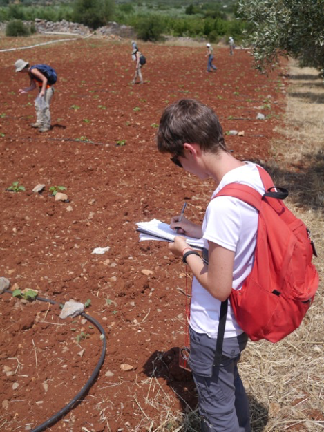
Some might say that BEARS has messed with the expected order of archaeological events – surveying a site that has already been excavated…can we do that?! It has been done before but usually surveys of excavated areas focus on “more modern” non-artifact collecting practices (e.g. GPR, LiDaR, etc.). Few sites have been subject to surface collection after trenches have been dug. But this is exactly what BEARS is doing at Koroni! This begs the question: how exactly does a surface survey contribute to our knowledge of a site that has already been excavated?

BEARS is technically the third archaeological survey to explore Koroni. The first was conducted by the American School of Classical Studies at Athens (ASCSA) in 1959, and another by the German Archaeological Institute (DAI) in 1986. Although the ASCSA collected a smattering of surface finds, both of these surveys focused on architectural documentation with particular research goals in mind. For the ASCSA, this was capturing the size of the site and identifying enough of the architecture in order to make an informed choice on where to excavate. For the DAI, the project goal was a localized architectural study of buildings on the hillslope, an area of the site largely ignored by the Americans.


When the Americans returned in 1960, they excavated for three weeks in spaces that were proximate to meaningful architectural features identified from the survey. This included areas in and around major gates to the fortification, well-preserved towers, and buildings situated at topographically accessible positions. The results of this excavation changed their interpretation of the site. They no longer thought it was a deme center but instead a short-term military camp built by the Ptolemaic army in the 260s BCE. The Germans then used architectural survey, as well as a re-contextualization of many of the finds, to argue that the site was in fact an Athenian site before the Ptolemaic troops arrived. The picture of the site has hovered around the first half of the third century BCE and the research questions have been largely historical – who lived there and when?

Our esteemed BEARS directors established a survey method that matches the unique situation of the survey area. For example, artifact densities were not a priority at Koroni, since these are typically used to identify a site in the landscape and everyone already knows that Koroni is a site! Instead, we collect surface material from the site and surrounding areas to get a sense of land use across the entire peninsula. Of course we are all still interested in who lived there and when, and architectural documentation will still be a priority – who can resist the chance to contribute to a new narrative! – but our holistic mode of data collection also creates new questions. How does this work?
First, the logistics. We collect what’s on the ground. We are certainly gathering parts of abandoned material from the excavations, but now we can say a lot more about material that was deemed ‘non-diagnostic’ in the mid-20th century and discarded by the excavators. There is no mention in the excavation notebooks of where these discard piles were located, but the high-quality of preservation of the BEARS pottery suggests we are picking up some artifacts that have been exposed on the surface for only 60 years. The high quality of the material might also relate to the fact that we’re surveying an area already designated as an archaeological zone – it is protected by Greek law from tampering or agricultural activity. The exposed bedrock on the top of the Koroni peninsula, where much of the previous work had been done before, prohibits a good diachronic picture of events at the site. Survey of the slopes of the hill and more intensive work in the valley, where soil has accumulated over time and agricultural activity and natural processes have kindly kicked up some of what’s hidden beneath the surface, have already expanded the chronological picture of activity on the peninsula (spoiler alert: the Bronze Age-rs also liked this picturesque peninsula!).
Second, new research questions! The BEARS data provides opportunities for new thoughts about the peninsula. Not just the fortification and its historical importance, but the topographic significance of the peninsula throughout time, connections to its hinterland, ways in which it was integrated into shipping lanes throughout the bay and beyond, etc. Casting a wider net in terms of data collection means we can tackle a whole new spectrum of research questions. Lastly, data processing and contextualization. Work on ancient ceramics, industry, and trade over the last 40-60 years has set us up to get more information from the material we collect. Studies of ceramic production centers, depositional assemblages, and patterns of distribution help us say a lot more about our humble surface sherds. In addition, thanks to BEARS’ work throughout the survey area, Koroni can be better understood within its wider regional environment. We know SO MUCH MORE than we ever did before about Porto Raphti, and now Koroni will be part of this larger diachronic picture.
We are always creating a new archaeological record. It changes, we change, and it’s worth it to keep asking new questions about old places even if we think we already have it all figured out.

Community Archaeology and BEARS: Where to Start?

The BEARS blog is very excited to share this post about the potential for developing some aspects of community-engaged archaeology in the context of the BEARS project, written by Joseph (aka Joey) Frankl. 

When the blog was founded in early 2020, the intention was for it to serve as a medium through which our small project community could exchange/share ideas, thoughts, and memories about BEARS over the spring and summer, since it had become clear that we probably wouldn’t get to see each other in the field for some time.  As it turns out, most people were far too busy with all of the chaos of pandemic life to put together contributions, which is totally understandable. We do hope that as life returns to normal, the project matures, and our many talented team members feel increasing ownership over the direction and goals of our work in East Attica, the sharing of ideas and in this space will likewise grow! 

With that in mind, it’s encouraging to have our first bona fide team member contribution to the blog since way back in early June, 2020And what a stellar piece it is – a sophisticated and thought-provoking consideration of what community-engaged archaeology in Greece and Porto Rafti might or should look like, and the many reasons that Classical archaeology has not traditionally been at the forefront of this sort of work.

Joey and Herakles discussing finds on Raftopoula (K. Alexakis)

This fall, I, along with several of my University of Michigan colleagues, organized a roundtable session about community-based archaeology. Community-based archaeology – or community-engaged/community archaeology – has been variously and widely defined, but is typically understood as archaeological practices that integrate community members with external research teams in the production, preservation, and dissemination of archaeological knowledge. As my co-organizers and I conceived the session, four archaeologists (working in different disciplinary and geographic contexts) would create a dialogue for our archaeological community concerning best practices of community archaeology and its future in the discipline of archaeology. Despite the technical difficulties of a remote format, the roundtable was a success! It’s clear that there is some really interesting work happening across the globe, work that is seriously attempting to make archaeology a more just and ethical discipline by integrating different types of stakeholders in the process of understanding of the past.

It was also painfully obvious how such practices seem absent from Classical Archaeology. This is not to say community-based archaeology does not exist in Mediterranean contexts. There are many good examples. But, generally speaking, community-based practices are simply not embedded in our disciplinary framework. (Do job searches in Classical Archaeology ask for community-based experience? Does the AIA annual meeting regularly include sessions dealing with the subject?) The reasons for the absence of community-engaged practices in Classical archaeology are complex and manifold. Classics and Classical Archaeology have tended to be slow on the uptake of critical, reflexive practices associated with post-colonialism, which have dictated disciplinary trends in the social sciences and humanities during the last several decades. Classical Archaeologists working abroad are also often associated with foreign research institutes that are unambiguously the vestiges, or contemporary products, of Northern European and American imperialism. Pursuing archaeology abroad was part of a larger project of Western knowledge production centered upon creating a history of European superiority. While foreign schools are increasingly working in collaboration with local archaeologists and there has been new success in community involvement, their institutional purpose is not oriented towards community engagement. 

The domed ceiling of Mon Repos, a British Lord Commissioner's pleasure villa, built atop the ancient city of Kerkyra ca. 1830 (S. Murray)

All this has resulted in serious structural barriers for Classical Archaeologists in pursuing community archaeology work. This includes lack of incentives for junior tenure track faculty pursuing such work, minimal funding, or the relative prestige of certain types of archaeological publications. Likewise, graduate training in Classical Archaeology typically does not incorporate skills necessary to do effective community-based archaeology, such as basic understanding of ethnographic methodology and ethical principles in the social sciences. (My colleagues in a socio-cultural anthropology seminar were aghast that a basic understanding of the modern geo-politicial context of the Mediterranean and the origins of my discipline were completely absent from my training. I have since decided that Hamilakis’ Nation and Its Ruins and Herzfeld’s Anthropology Through the Looking Glass really should be required reading for any graduate student working in Greece!) Additionally, to pursue effective community based archaeology, at a bare minimum, requires proficiency in the language of the communities in which one works. I have worked in Greece for the last five summers and still have only the most basic conversation skills in Greek. Instead of learning to speak Greek, I have spent much of my early graduate career trying to master Ancient Greek, Latin, French, and German, languages that are actually required for my degree. I am not excusing myself from my lack of proficiency in Greek––there are many in my program who have managed to learn Greek alongside these other languages. But it remains clear to me, from a structural perspective, graduate programs such as mine are not foregrounding knowledge of spoken modern languages in archaeological education.    

A garage door in the Spanish colonial outpost of Sidi Ifni, Morocco channels Classical Archaeology's attitude towards community engagement (S. Murray)

In our first BEARS season, which seems o so long ago, our team did not pursue any form of community-based archaeology. For the most part, we were simply trying to stay afloat completing our archaeological research and trying to do it well (of course, this was the work that was laid out in the grants and fellowships that were financially supporting us!). Despite this devotion to our archaeological research, our team did not remain in an isolated compound, apart from the hustle and bustle Porto Raphtis––a common critique of Classical archaeologists. On one day of fieldwork, we were lucky enough to be joined by a local poet, who described the kinetic beauty of work; our faithful captain Vasilis, and his son Odysseus, became important members of our team; and of course we frequented the tavernas and cafes that lined the city’s seaside (editor’s note: Joey and several other members of the team also became good friends with Herakles Tsonos, our supervisor from the Greek archaeological service). It is also clear that there are serious obstacles in pursuing effective community-based archaeology at Porto Rafti. For one, there are issues of permits, planning, and finances. A well-conceived community-engaged archaeology project requires close attention to local history and social bonds forged through sustained conversation. This requires the right personnel and years of planning – neither of which our current archaeological project is equipped to do.  Also, Porto Rafti seems to lack a community environment that you might expect in Greek city or village. The city is relatively young and lacks a feeling of deep generational community. There is also no plateia, and there many, many vacation homes, rather than year-round residents. All this makes the prospect of doing some type of community work daunting. 

The Porto Rafti Harbor at dawn (photo credit K. Alexakis)

This blog post is really meant to think through this problem and envision what community-based work would look like at Porto Rafti. I am under no illusions of the difficulties it would require to undertake such work, but I do hope to offer a few starting points that might help our project begin to look outward and integrate our research into the contemporary context. So, here are a few possible starting points, however modest, for moving towards a community-based archaeology at BEARS.

1.  Start conversations with the community. This seems basic, but it is truly     the first step. Community archaeology should emerge from the needs of a community, not from the research agendas of archaeologists. These conversations might emerge from public presentations about our work or “open house” style discussions. These discussions are important for identifying what archaeology and the past mean to the residents of Porto Rafti, while detecting interest in specific elements of our project. 

2. Regularly discuss the contemporary context of our work as a team. Why do foreign archaeologists work in Greece? This is such a fundamental question, but one that needs to be discussed again and again. As a team, it will be important to understand the role of foreign schools in Greece and the essential critiques of the schools generated by scholars like Herzfeld and Hamilakis. Furthermore, we need to understand Greece’s current place in geo-political conflicts of the last several decades and the way in which archaeology fits into past and present conceptions of Greek nationalism. These are all BIG subjects, but such conversations are an essential starting point for critically understanding our own positionality as foreign archaeologists. 

3. Collaboration and connection by thinking about the past and present. During the roundtable, I noticed that many of the best elements of the community-based projects revolved around points of similarity between the past and present. Most often, these were the similarities between the ways in which people in the past and people in the present utilize local resources (whether in the process of food consumption or artistic production). Our interest in ancient Porto Rafti focuses on the bay, its settlement patterns, the exploitation of marine resources, and the waterway as a source of connectivity. Connecting with those who work at the city’s main port, fisherman and sailors alike, might be important first step in understanding the connections between our material interest and current issues of climate, resources, and topography. This would also be important in understanding the way that the ancient landscape has affected contemporary life, such as the designation of Raftis and Koroni as archaeological zones.       

When we (hopefully) return to Porto Rafti this summer for a full field season, I’m not sure how well we can act on these suggestions. We’ll have a lot of archaeological work ahead of us and community-engaged practices are time consuming and significant labor. So, I hope this post will serve as a conversation point as we move forward to reflexively consider our research and our role as foreign guests in Porto Rafti. 

Sofia Gliati-Chasioti's book on the history of Porto Rafti (G. Psaltis)

Architecture and Mud Brick at Koroni and Elsewhere

In our short pilot season last June we had only just gotten started documenting and studying the abundant architectural remains visible on the sites of Raftis and Koroni. That was something that we had big plans for this summer, but that work is going to have to be pushed forward to 2021, or whenever our fieldwork can safely resume. To produce a proper documentation of the built remains of these sites we’ll need to spend a lot of time cleaning wall foundations, mapping with the dGPS, and (where appropriate) drawing and conducting photogrammetric recording to produce accurate stone-by-stone plans and sections of well-preserved walls and buildings. 

The purpose of this work is not just to create obsessively thorough records of the archaeology of the area, although that’s certainly part of the goal. Another goal is to date the architecture based on its construction style or associated artifacts, although that’s always complicated to do in a survey context with relatively scrappy walls. We’ll also use our careful study of the architecture to try to reconstruct the original appearance of the buildings. 

All of the architecture we’ve observed in the Porto Rafti area consists of relatively low-lying foundations made of rough field stones – no ashlar blocks or cut stones, at least so far. 

A ruined structure on the Koroni acropolis (Photo credit: M. McHugh)

When it comes to reconstructing the original appearance of the built structures represented by these walls, an important question is what the upper part of the architecture would have been made of. A major issue that comes into play here is the question of mud brick. A lot of architecture in the ancient Aegean was built primarily of mud brick on top of a stone foundation (which would prevent groundwater from damaging the bricks). For obvious reasons, mud-brick portions of buildings don’t survive as well as stone components, so we rarely find well-preserved mud-brick architecture, even in excavations. Mud-brick in survey contexts is basically unheard of.

The remains of a mud-brick upper in the fortifications at ancient Eleusis (S. Murray)

One of the many strange conclusions reached by the team of American archaeologists that worked on Koroni around 1960 was that there was absolutely NO mud brick used on the site whatsoever. Apparently the guy who studied the architecture, James McCredie, came to this conclusion because there were no traces of mud-brick apparent on the walls and because there was a lot of collapsed rubble around on the ground. 

That sounds like a pretty silly, flippant argument to me, and I’m guessing when we study the architecture up there more carefully we’ll find plenty of reason to believe that mud brick was used in construction on Koroni. Certainly most of the walls I was documenting on Raftis island look like stone foundations for mud-brick superstructures. In any case, those are the kinds of questions our architecture team will be chewing on next season: what kinds of construction techniques and construction materials are we dealing with, how large would these buildings have been originally, etc.

In conversations about ancient Aegean architecture, I find that mud brick has kind of a spectral mystique. Especially recently, because of my work in architectural documentation on the Mazi Archaeological Project, I’ve spent a fair amount of time working on architecture, and we talk about mud brick as a component of the built environment all the time. We know it was an important part of the architectural landscape in the Aegean, but it rarely exists for us to look at or study as a physical object. We just have to imagine what the mud-brick portions of buildings from the ancient Aegean would have originally looked like, because there is not much of them left. 

A wall of luscious mud brick punctuated with wooden beams outside of Chachapoyas in Peru. The careful observer will be attentive to the tidy running bond pattern used here.

Although most people might think of mud brick as a humble building material, it’s actually completely superior to stone in a lot of ways. It’s great for temperature regulation, keeping out heat in the summer and retaining warmth in the winter, like an animal burrow. The bricks can be made of of widely availably material and are easy and fast to manufacture. They are more modular and regular than, e.g., fieldstones, but they don’t require laborious quarrying, like cut stones (actually, it seems likely that the idea to cut regular stones for architecture came from the shape and utility of modular mud brick construction). As long as they are protected from moisture at the base and top, with some kind of footing and roofing, they can last a really long time, but the structures are easily modified nonetheless. Mud brick is very strong and adaptable and can be used for all kinds of things you might not expect, like vaults and arches. Even though we associate mud with grim filthiness, mud-brick architecture can be incredibly tidy and neat if it is well-maintained. 

Tidy and very thoroughly mortared mud brick in Benito Juarez, Oaxaca province, Mexico.

In sum, mud brick is much more boss than some people give it credit for. Whenever I travel in places where there is a lot of extant mud brick architecture I become very excited and take many photographs of mud brick buildings or remains – these are great for boring your family (or blog readers) with when there’s not much else to talk about or you want to avoid a difficult topic. On a tip from an old friend Adam Stack,  I once stopped into Chachapoyas, a colonial town in northern Peru that is named after a local tribe, whose name means “Cloud Warriors”. This is not the only awesome thing about the town, but it has a lot of great old-school mud-brick architecture. Most of it is plastered over to present a cheery white colonial facade, but there are plenty of places where you can see the construction materials at the interstices. These people do a mean mud brick.

Exposed mud brick elevation in downtown Chachapoyas.
In addition to being used for brick-making, mud is layered over transverse vegetal matting used to protect the wooden ceiling beams in the Chachapoyas architectural style. Just goes to show that it takes much more than one material to roof a house, although we tend to focus on the tiles in survey archaeology.

I also saw some great mud architecture in Kenya a couple of summers ago. The Kenyan villagers tend to use a much wider variety of different techniques for employing mud in their architecture than the Cloud Warriors. There were houses made of regular, mortared mud-bricks, wattle-and-daub, and a kind of hybrid multi-media wood and mud structure that I guess you could call a version of half-timbering. 

A small mud-brick home in northern Kenya, partly repaired with cement, perhaps, at right.
Half-timbered and wattle and daub mud construction on display in northern Kenya.

By far the greatest place to check out the soaring possibilities of mud brick architecture that I’ve ever been, however, is Morocco. That is not to say that the bounteous abundance of mud brick architecture is the only or even the main reason that Morocco is an amazing place to travel. I have never, ever, been in a place with such consistently stupefyingly beautiful landscapes as the ones in Morocco, especially once you get south of the High Atlas mountains, where the geology is stripped clean of most vegetation and you can see the naked, orange-and-red striated evidence of ancient tectonic action all over the place. There are also many dizzyingly steep and epic gorges and canyons to explore, and ample herds of roaming camels and donkeys to accompany your expeditions. Once you get south of the Anti-Atlas AND the Sahel, you can check out some real honest-to-goodness sand dune fields, whose otherworldly orange glows combine with the bright blue Saharan skies to produce an overall aesthetic effect that can only be described as enchanting. The Atlantic coast is dramatically gnarly, its beaches littered with shipwrecks, sleepy diurnal owls, and confusing vistas of green coastal lushness interspersed with massive dune fields emptying directly into the sea. Yeesh, if you can visit Morocco and not spend half of time time with your eyeballs rolling back into the back of your head from too much retina-burning stimulus, you are a stronger person than I’ll ever be.

The landscape around Tizgui-Ida-Ou-Baloul
Halva-geology around Tizgui-Ida-Ou-Baloul.
An Agadir and its oasis in a dramatic gorge west of Tizaghte
Donkey and camel party outside of Mghimina.
The untamed orange sands of the Erg Chebbi. It doesn't even look real!
Fishing boat, estuary, and Sahara dunes coexist in Knifiss National Park.

Returning to the mud brick situation, however, if you are a fan of mud bricks, you seriously ought to get out and visit Morocco as soon as you can. Once you get into the desert regions where building materials are somewhat limited, the quantity of mud brick architecture is seriously unbelievable. Mud brick is used to make everything from the fanciest palaces to everyday houses. 

There are still a lot of sprawling oasis towns that are almost entirely made of mud architecture, with only a few modern concrete structures mixed in to replace failed buildings or to serve the modernizing ambitions of the few local oligarchs. There are also quite a lot of places where the mud-brick ‘old town’ has been totally abandoned, to be replaced by a new concrete town right next door. Even once they are abandoned, the mud brick villages in Morocco last for a long time because of the relatively dry climate, and so there are a lot of totally abandoned but relatively intact villages to investigate.

View over Taghmoute, where the urban fabric is a mixture of mud brick ruins, mud brick masterpieces, and modern concrete constructions.
Mud-brick Acropolis of Tazarte rising majestically from the palm trees.
A whole ruined mud brick neighbourhood in Tazarte.

As I said before, not only typical village architecture but also the most grandiose palaces are made of mud brick in the old Berber villages of Morocco. It’s pretty incredible to see just how tall, intricate, and complex of a structure can be built just with dirt, essentially. The Anti-Atlas region is full of these massive kasbahs, built to house the local lords of Berber tribes. They are often really big, up to five or six stories, and the towers are usually elaborately decorated with crenellations, decorative designs that look like something from a Gothic cathedral, and arches or other forms of window dressing. Looking at these always makes me think of the ziggurats of the ancient Near East – and is a powerful reminder that a castle built from mud can be just as imposing, monumental, and intimidating as one made from stone.

Ruinous mud brick Kasbah near Taliouine.
Decorative multi-level mud-brick constructions in the Kasbah at Tamnougalt.
A sprawling mud-brick kasbah in the shadow of the high Atlas near Telouet.
Decorative kasbah towers of Sidi-bou-Said

Of course, not every building in the village is going to be a massive, elaborately impressive kasbah. But the less-grandiose domestic architecture can be just as interesting and impressive in its fastidious construction techniques. The mud-brick in Morocco usually involves some mortar, used at the horizontal joints of courses and containing some kind of temper, usually straw. Usually the method of bonding or stacking the bricks is relatively regular, although many different techniques can be observed, including some cool houses that combine stones and mud bricks to excellent structural and aesthetic effect. Much of the time the exterior of the bricks is plastered over with the hay-tempered mortar, and then this mortar is painted very bright colors at strategic positions like gates or windows, for an extremely jaunty effect. 

Tiered mud-brick town of Zaouia-Timguidcht
The top of a mud-brick wall against the blue Moroccan sky near Ifrane.
Brightly painted door on a mud-brick house near Tighmert.

In addition to the mud bricks themselves, these structures usually employ a lot of wooden and vegetal elements, especially mats or bundles of reeds available in the oueds that run through most of the major canyon and valley systems, and also the fronds and trunks of the abundant palm trees that populate the oasis towns. The roofs were usually flat and made of palm beams that supported reed or palm rib matting in between, which matting was covered over with a layer of the mud plaster. Wood was also usually used for the windows and the doors, interior supports/columns, and lintels, especially when stone was not available or considered to be too expensive. Often times the builders don’t really even bother processing the vegetal matter, so you’ll see very raw tree trunks and branches just jammed right into the construction.

Lackadaisical palm branches not quite serving as a roof in Taghmoute.
An extant palm trunk and reed roof combination in the agadir of Akka Ighane.
Mud brick and thatch houses a bit worse for the wear in Assa.

If you can only go to one area to check out mud-based architecture in Morocco, the place to be is the region of Rissani in the south central part of the country, near the Algerian border. The modern ‘town’ of Rissani comprises a cluster of structures called ksour, groups of neighborhoods or communities surrounded by massive defensive walls and accessed through monumental gates – all of which (houses and defenses) are made of mud-brick. Inside those monumental gates are whole small, sheltered worlds of mud-brick. You can usually even find stacks of raw materials lying around, too, like palm trunks and buckets of sludge for mortar repairs. People still live in these places, which is good, because it is easy to get lost in the warren of intricate passageways, and you’ll often need help finding the way  out.

Decorated entrance to one of the mud-brick ksour of Rissani.
A mud-brick encased passageway deep inside a Rissani ksar.
Mud brick neighborhood in a Rissani ksar; note the palm thatch employed for roofing at left.
Mud brick for miles in the Rissani ksar.
Expanses upon expanses of mud-based architecture in Rissani.
Brightly decorated mud-brick gate, and a mosque tower rising above, to one of the Rissani ksour.

Anyway, Rissani is amazing! I highly recommend it to anyone who wants to learn more about mud brick architecture and how much a good builder can achieve with it. That said, of course it is very unlikely that the mud brick architecture we’d be reconstructing for either Koroni or Raftis was anything so magnificent/elaborate as any of this Moroccan architecture. But, just in the abstract, it’s educational to spend time around real-life specimens of mud-brick, because they give you a real sense of the advantages and possibilities of the material. 

In the Aegean it seems like we have a real bias towards the study of hard things – especially rocks and ceramics – which often leads us to  underplay the importance of the kinds of materials that don’t survive as well. I think there’s also this conception in our field that something monumental must be made of stone, and that something made of mud brick was not so impressive. But checking out some real good and proper mud architecture in Morocco will quickly disabuse anybody rational of that notion. 

I’m definitely not on board with with McCredie’s argument that Koroni couldn’t have had any mud brick architecture. I wonder if he thought it would be unmanly for his military camp occupants to use such a weak, soft material for building their fortification walls…or maybe he thought that these guys were in such a hurry to throw up a wall for their sudden Chremonidean war needs that they couldn’t have been bothered to manufacture any special material for construction. Anyway, who knows – those are just my stray thoughts for the day. For now the team is stuck indoors for the most part, so we’ll have to wait and see what we come up with in terms of architectural reconstructions after additional study of the walls next year.

Fuzzy baby donkey at Tighmert definitely approves of his mud-brick wall surroundings.

Post-Collapse Ruins in the Landscape beyond the Aegean: Georgia

One of the questions that we are trying to address with the BEARS project relates to the bigger issue of what was going on during the twelfth century BCE, after the so-called collapse of the complex ‘palatial’ states that loom large in the material record of the Aegean before that. The question of how society developed in this period is absolutely my favorite professional research topic.  This is not unrelated to my lifelong romance with post-apocalyptic fiction – in turn, the general popularity of this genre proves the point that we humans are eternally fascinated by the idea of moving forward with life amidst various kinds of aftermaths.

My particular perspective on life in the post-collapse Aegean has been strongly influenced by travels in other parts of the world, where (unlike most places I’ve lived in North America) you are often surrounded by ruins of the recent past. None of these contexts provides a perfect analogy for what happened in the Bronze Age, or any archaeological situation, obviously, but I find that wandering around among recent ruins is evocative in a way that just thinking intellectually about the LBA collapse is not.

Although I’ve had a lot of interesting experiences along these lines in many places, I have come up with many of my best ideas about what happens when you are living in the aftermath of a collapsed state while traveling in Georgia, which used to be a part of the Soviet Union. 

There are all kinds reasons I would recommend Georgia as a destination for travel – the people are extremely kind, fun, and welcoming; the food and wine are seriously unsurpassed (and I don’t even like food or wine that much!); the natural environment is stunning and hugely varied from region to region; there are SO many awesome barnyard animals everywhere (my favorite thing); it’s cheap as heck; the driving is an adventure; the birding is spectacular – I could keep going.

Epic landscape of the Svaneti region in the Georgian Caucasus
Friendly locals near Paravani lake in SW Georgia
A fulsome herd of road sheep in the Kakheti region, as seen from the car window.
A curious pony hangs out in Tusheti, the wildest Georgian mountain region of them all.

But as an archaeologist, the most fascinating and rewarding thing to me about traveling in Georgia is the ruinous landscape situation – Georgia is full of all sorts of ruins and crumbling, forgotten monuments, sometimes sitting cheek-by-jowl with state-of-the-art modern police stations and megamalls. Unlike the situation in Greece, most of these ruins are not what we’d usually call archaeological sites. Most of the ruins in Georgia are remainders of a very recent past, a past during which life in the country was very different from how it is today. They are mostly ruins and images from the 1940s to 1980s, left behind in the aftermath of the collapse of the Soviet Union.

Noseless Soviet man brandishing an aluminum weapon in a small village near Vardzia in southern Georgia.
A large semicircular structure celebrating Soviet victory in WW II, located on the Russian Georgian military highway through the Caucasus. Note the swastika being stomped by the jolly green giant at center.
A disused bureau of science in Tbilisi
A hay truck rumbles past an old Soviet military monument in southeastern Georgia.

Georgia has an interesting relationship with its Soviet past. I won’t go into too much detail, and obviously I’m not an expert on the topic, but let’s just say that the region has a long, proud historical tradition and culture of its own (Davit the Builder, ya heard?!), and Georgians often chafed under the Soviet regime. They officially declared independence from the USSR in March 1991, before its official dissolution in December 1991. The new Georgian state has – more or less – enthusiastically embraced democracy and the cultivation of an Europeanizing cultural identity since then. Although the Abkhazia/South Ossetia situations make it clear things are, as ever, quite more complicated than they might appear to the naive outsider, from my experience there does not seem to be a lot of nostalgia for the Soviet past in most places there.

On the other hand, probably the most famous Georgian in history is a fellow from the city of Gori originally called Joseph Jugashvili, better known to the world as Joseph Stalin. Obviously Stalin was a bad dude, and lots of Georgians, especially intellectuals, were persecuted and killed under Stalinist rule. Many others died of hunger or other collateral effects of policies put into effect by Stalin. But there seems to be some residual pride in Georgia about their most famous son, especially regarding his role in leading the Red Army against the Nazis in WW II. In Stalin’s hometown of Gori, you can still visit a big hagiographic Stalin museum and purchase sundry Stalin-themed merch in the gift shop on the way out.

Stalin tapestry in the Museum dedicated to his life in Gori

Even more amazing from a western point of view, a massive, very monumental statue of ol’ Joey Steel in the center of Gori was only destroyed in 2008, in the aftermath of the Russian bombing and the eruption of conflicts over Abkhazia and South Ossetia. If you travel around Georgia you will still see vivid portraits of Stalin on a regular basis. Usually, but not always, these are part of WW II memorials – which have often been both actively maintained and spared from vandalism out of respect for the war dead, unlike a lot of other art from the same period. Staggering numbers of Georgians fought and died in WW II, and the people are rightly proud of the sacrifices they made in that conflict.  

A nice Stalin watercolor painting watches over a war memorial in the Kakheti region of Georgia.
A Lenin-Stalin pebble mosaic above the door to a cable-car station in Chiatura.

On balance I think it’d be fair to say that there’s more ambivalence about the role of the Soviet past in Georgia than you might find in some other places. For whatever reason – residual pride in the Stalin connection, a generally reticent attitude towards destruction of art, or disinterest in wasting a bunch of time thoroughly dismantling all remnants of the Soviet past – many vestiges of the Soviet era remain.

As an archaeologist, and someone who grew up in the United States in the 80s, when the Soviet Union embodied all of the bad guys and scary ideas in pop culture, nuclear shelter drills were part of grade school preparedness routines, and films like War Games  captured every young kid’s imagination, I find being immersed in these ruins endlessly fascinating and bewildering.

I will never forget the moment that I saw a massive propaganda mosaic looming from the giant vertical expanse of a factory wall in Georgia for the first time, in the summer of 2013. I was totally agog and spent like an hour freaking out about it, and couldn’t think about anything else for days. The aesthetic is very different from what I had ever seen in western art – the subject matter, too, but there was something completely stupendous to me about how differently the conception of the human form and the presentation of society’s ideals and all that kind of stuff seemed to work compared to what I was used to. Not to mention the fact that some of those mosaics are amazingly beautiful and seductive as design masterpieces. I can see why nobody wanted to destroy them, even though they come from a past about which people are ambivalent. But it’s also clear that the independent Georgian state hasn’t shown any interest in preserving them. A lot are in bad shape, crumbling off of walls or being papered over with political adds. 

Some compositions are very virtuoso, although you can really tell the difference between the early, technically perfect ones from the Soviet heyday, and the sloppier 1980s ones from when the wheels were starting to come off the state. I can imagine that budgetary cuts to the propaganda mosaic department in the late 80s were a lot like those being handed down to humanities departments at red state schools in the US right now! 

Anyway, I really can’t get enough of these things. It’s so amazing to me when I think about the nasty realities we were taught about the Soviet Union growing up in school, to be in a place where you can see the story the state was telling inside of its borders at the exact same time. It’s all these bright, cheery depictions of happy workers and science heroes and fecundity and people dancing and making wine! 

Spacemen and others on an urban mosaic in Abasha.
Mosaic buddies lurk on a factory wall behind a coil of barbed wire.
A monumental mosaic showing heroic workers on a factory wall near Zestafoni.
Marching in orderly agricultural harmony and joy near Batumi
An autoshop mosaic depicting the evolution of the Lada, outside of Tbilisi
The flaccid 80s style still shows a muscular emphasis on industry and science, next to a rail line heading into Tbilisi.
A mosaic not long for this world on the side of an old factory near Batumi.

Although the happiness of the workers is very likely to be exaggerated in the mosaics, it’s actually true that there was a lot of industrial work being done in massive, purpose-built facilities in Georgia under the Soviets. That brings me to another category of recent ruins that dominates the landscape – huge, hulking industrial complexes that were obviously designed to satisfy the demands of a sprawling empire, but which were mostly abandoned after its demise. The best place to go and see these decaying industrial landscapes is the area around Rustavi, just southeast of Tbilisi, but there are a lot scattered all around the lowlands and valleys between Tbilisi and the Black Sea, too. 

Rustavi’s dystopian landscape of concrete communal housing blocks was obviously the home of a huge army of workers that populated an even bigger complex of steel-production facilities. A few of the Rustavi steel working plants have recently been bought up by Indian companies and repurposed for the modern era, but others are still being picked through for scrap glass and metal. The noxious fumes emitting from the biggest Rustavi steel plant ruin suggest that it probably got destroyed by some superfund-type disaster that never got cleaned up, so nobody really hangs out there. 

But some of the other facilities are still in use informally – as smithies or places to harvest equipment and other materials needed for construction, home repair, or whatever. People are not exactly wealthy in the Georgian countryside, so I think for them it would be hard to afford, say, a new tractor. If one is lying around and you can get it to work, why not use it? You have to admire their determination to keep on cracking away with whatever industrial equipment the Soviets left behind until it no longer keeps on keepin’ on itself. Tractors, excavators, conveyor belts, welders – you name it, you will see mid-century CCCP equipment still in very active use all over the place. And if something won’t work as what it was intended to be, you can always be creative and find a way to use it for something else!

Among the ruins of a steel-working facility in Rustavi.
Old equipment intact inside of a massive glass-bottling factory near Surami in the central lowlands of Georgia.
Sinister-looking graphite-type lugs in the ruins of an industrial complex in Surami.
Pinups in an employee's locker in the ruins of an industrial complex near Surami.

By far my favorite place in all of Georgia is the town of Chiatura, located in a dingy, usually rainy ravine in the Caucasus foothills not too far from the western border of the breakaway region of South Ossetia. I won’t talk too much about Chiatura here – you can read about it in Slate or Atlas Obscura instead. Long story short, Chiatura was developed as a mining town because the ravine in which it’s located is rich in manganese. To help get workers around the complex topography, the Soviets built a series of low-tech cable-cars in the 1950s. You could still ride around on them when I visited in 2013, 2014, and 2016, but one by one they are falling apart and being cannibalized for spare parts. The old mining facilities are also being used in the same manner – until they stop working. Whenever they do, they are reused for other stuff – in 2016, one old disused mining facility was being used by a group of shepherds to tan hides. 

View into the ravine of Chiatura from one of many cable-cars that traverse its topography.
Typical weather in Chiatura, a Lada, and the Manganese sign at the entrance to the town.
An old photo of the manganese glory days seen taped to the wall of one of the cable car stations.
View from the departures level of the light blue cable car terminal.
The rickety tower of flywheels and cables that keeps the whole operation moving.
A passenger peers through the window of an orange cable car in Chiatura.
Friendly shepherds operating a tannery out of what used to be an industrial facility just outside of Chiatura.

In general, given our western culture of waste and constant replacement of old stuff as soon as something better comes along, I think it’s cool to see how resourceful the Georgians are at making use of whatever is around them that can still be made useful. I once saw a guy using a three-legged chair as an umbrella! Talk about thinking outside of the box.

An old Soviet train car being used as a bridge over a fast-moving torrent near Vardzia in southwestern Georgia. You gotta wonder how the hell they rigged this up!
The hind end of a Lada repurposed as the hind end of a horse-drawn buggy in the Kakheti region.

Aside from industrial ruins, another coherent set of ruins in Georgia are  Soviet-era cultural amenities. Because Georgia is a relatively mountainous country and home to a number of mineral springs, the Soviets developed some nice resort-type spa towns for wealthy plutocrats to visit on their vacations. So far I’ve only been to two of these – Tskhvarichamia near Tbilisi and Tskaltubo out west near the city of Kutaisi. Outside of Tskvarichamia is a long cinder-block wall covered in a series of colored terracotta relief panels that presents one incredibly complex and intricate propaganda tale – I’d need a whole other post to cover it! And there are some cool other ruins of statues there. But most of the fancy spa hotels of Tskhvarichamia have – in tried and true Georgian way – been repurposed, this time as makeshift, not-exactly-on-the-books apartments (Georgians are seriously superninjas of splicing into power grids). 

Tskaltubo is in the midst of being revived as a mineral spa bath town, so most of the squatters have been kicked out of its fancy old spa buildings, making it possible to wander in and check out what was left behind. Inside the ruins of those spa baths were a lot of papers, photos, and objects from back in the good old days when the apparatchniks descended on the town for feasting and sport, and maybe the not so good old days when sick people visited to take the cure of the mineral waters and healthy airs. If you were an archaeologist of the Soviet past I can imagine that stuff would be a real treasure trove of documentary and artifactual evidence.

Hundreds of meters of terracotta art on the mountain road leading up to Tskhvarichamia.
Sputnik spacemen on one of the panels of the Tzkvarichamia triumph wall.
Nature reclaims a statue outside of the old spa town of Tzkhvarichamia.
A photo of vacationing plutocrats taped to the wall of an old spa hotel in Tskaltubo.
Medical records litter the ruins of the old spa hotels of Tskaltubo.

One of the few common types of ruin in Georgia that seems to have been more or less left intact, but mostly gutted, and never repurposed or reused is the Stalinist theater. Almost every town in Georgia has a big, empty, ruined Stalinist theater. I’m guessing people were forced to go watch propaganda films in these places, and maybe they don’t have so many fond memories of that. Or maybe the buildings are just too specialized to have much use for modern communities.

The stately facade of a disused Stalinist theater building in one of the suburbs of Chiatura.
Soviet style wall-paintings inside of the disused theater outside of Chiatura.
The charred ruins of a Stalinist theater in Kvareli.
Actor-themed art outside the old theater in Zugdidi.

The last type of Soviet ruin I’ve encountered in the Georgian countryside are the remains of obviously military installations. These have a completely different demeanor these days than any other Georgian ruins – they have obviously been purposefully and completely annihilated, and stripped down to a bare core of useless concrete. I’d guess that the Soviets intentionally and completely destroyed any useful military emplacements prior to pulling out their forces, for the obvious reason that the independent Georgian state couldn’t turn around and use any of the military technology or equipment against them in future conflicts. But I don’t really know the story there.

The ruins of some kind of military facility near Dedoplitskaro.
Detail of concrete kablammos in the military ruin northwest of Dedoplitskaro.
Horses wander about in a blown-up military base near Tbilisi

Something that really strikes me about this material is how complicated a picture of the relationship of people with the past and their built environment it presents – even in a case where the “collapse” in question was something so dramatic, so global, and so definitive as the demise of the Soviet Union. While some stuff was obviously annihilated or gutted purposefully, like the military bases or the theaters, a lot of things remained in use or were kept up, and still others were just passively left to die a natural death. Thinking about this always reminds me that the story of the post-Mycenaean period must have been complicated and piecemeal too. Not that it’s an exact analogy, but I just find that physically moving among these ruins provides a lot of food for thought when I come back to consider the Bronze Age.

It also makes me kind of sad that I didn’t study material culture in post-Soviet circumstances instead of post-Mycenaean ones in college and grad school. Not that I even knew that was a topic at the time – I tried to take a Russian literature course as a freshman at Dartmouth but couldn’t hack it and basically failed out – or that it’s an obvious thing someone would study now.  Anyway, it’s too late for me! I am not sure if there is any good English language scholarship on the history and reception of these monuments in places like Georgia, but it sure would be a fascinating book to write for someone with the requisite language skills and art historical training.

A WW II memorial in the Kakheti region in June 2013.
The very same WW II memorial, blown into bits, in June 2014.
A young Georgian boy plays in the shadow of a Soviet war memorial near an old communal housing block in Chiatura.

Acquiring Spatial Data in Archaeological Survey

The author at mapping battle stations on the site of Eleutherai in 2015 (photo credit: A. Knodell)

Gathering spatial data is a core aspect of archaeological fieldwork. Whether on a survey or an excavation, we spend a lot of time finding walls, artifacts, and other features, and the location of those things needs to be mapped, documented, and eventually published in the form of plans, elevations, maps, etc.  Some measurement are best taken using tried and true analog methods, but if you want to acquire a lot of accurate spatial data or measurements, it helps to turn to technological solutions. 

The thing that I’ve been in charge of most often on survey and excavation projects is using these sorts of technological solutions to acquire and manage spatial data. I don’t feel like I’m all that old, but it is pretty amazing how much this technology has evolved since I started out on my first project in 2003, and even in just the last five years. BEARS team members will know that we’ve been using a new EMLID REACH RS+ dGPS unit to acquire spatial data on our project and that I am very enthused about this product and its implications for archaeological fieldwork. To put that excitement into context for everyone, I thought it would be helpful to review the kinds of options for gathering spatial data I’ve used in my career, and why the EMLID is such a game changer.

Walls upon walls to be mapped and planned at Korfos Kalamianos (Photo credit S. Murray)

If you have worked on an excavation project, you will probably be familiar with what is still the best tool for gathering accurate spatial data rapidly – the Total Station, aka Theodolite, aka EDM (Electronic Distance Measurement) unit. A Total Station is an instrument that uses optics to measure distance, equipped with an internal computer that triangulates positional data. Once a Total Station is set up, it is easy to take hundreds and hundreds of readings from it very rapidly. The data can be very accurate. 

However, Total Stations are basically useless for survey projects – the setup requires triangulation from highly precise reference datums, and you are obviously not going to have a dense network of precise datums throughout a whole survey region. The setup for a Total Station is time-consuming, so even if by some miracle you had good datums everywhere, you’d be wasting huge amounts of time setting up the station every time you found a random wall or foundation in a unit. Maybe most importantly, the Total Station is heavy and bulky, so not a good companion for field traipsers.

A Topcon Total Station ready to capture spatial data on the site of Damnoni in southwestern Crete (photo credit: S. Murray)

Archaeological projects at the level of the region usually employ GPS technology instead. GPS provides location data by calculating distance from a receiver to at least four known satellites’ positions based on the time required to transmit a signal between the receiver and the satellites. It then triangulates the receiver’s position based on those distances. 

On my first survey project, the SHARP project around Korfos in the eastern Peloponnese, handheld GPS units were being used to map  architectural features. Handheld GPS units were – at that time, ca. 2008 – cheap and widely available, so at first glance quite well suited to survey.  However, handheld GPS units are not great when it comes to data quality. Like most basic GPS units, they use a kind of technology called Single-point Positioning (SPP). It’s just what it sounds like – the GPS position you get on the readout is based on the calculation of a single point, a single calculation of the GPS receiver’s position based on data from whichever satellites that GPS receiver can receive data from. 

SPP is the most common form of GPS measurement (this is what the location data in your phone, your car, or hiking GPS is based on), but also the least accurate. A single-frequency GPS calculation of position is subject to a wide variety of errors, especially ones arising due to atmospheric distortions that impact the reading of distance from the receiver to the satellites. As a result, SPP GPS data is not very precise – usually you will know where you are within a range of 3–5 meters. 

This is obviously fine if you are trying to find the nearest smoothie joint or stay on a hiking trail, but not so great for archaeological fieldwork. We learned this the hard way at SHARP – there were a lot of walls in the survey area, but most were not much longer than, say, 3–5 meters. Given the large error range of the GPS units, the “maps” we made of walls and buildings by taking points with handheld receivers looked more like children’s scribbles than like scientific documentation. And walls were close together, so it was usually impossible to tell, from the GPS-generated GIS map, which wall was supposed to be which when we went back in the field to check and refine the data. It was a real nightmare, and we ended up having to go back and basically start everything over with a new system, including renumbering most of the walls.

This is not to say that SPP GPS is useless for survey archaeologists. The receivers are small, easy to use, and fit in your pocket – I still use them all the time to record the general location of a feature in the landscape, remember the best path through maquis patches, or just  get a handle of where I am while wandering around. But SPP GPS is demonstrably inadequate as a solution to the problem of precise (2-4 cm accuracy) geospatial recording in the context of archaeological field projects.

Handheld GPS units can be very useful for general purposes of navigation even if they aren't all that accurate (Photo credit: S. Murray)

For sub-meter measurements, differential positioning is necessary. Differential GPS requires that two separate GPS receivers be set up nearby one another, tracking the same satellites. One receiver (the base station) is installed on a known point (a datum), and generates differential correction data according to calculations based on disparities between its known location and the raw satellite readings of its location. Another receiver (the rover) is used to collect positional data, which is then refined based on the corrections calculated by the local base station to reduce error. When these refined readings are being received by the rover in real time, so that the coordinates you are seeing on the rover interface reflect the corrected rather than the raw data, that’s called real-time kinematic (RTK) dGPS.

At SHARP, the project decided that the best solution to its substantial mapping needs was to bring out an RTK dGPS system to document all of the project’s architecture. We basically scrapped a lot of the work we had done with the handheld GPS units. Remapping everything with the dGPS was quite laborious. It is more time consuming to map with dGPS than with a Total Station, because with dGPS you want to take a bunch of readings and average them together, which irons out any randomly bad satellite data that might come down the line for various reasons. To get 2-4 centimeter accuracy data you should let the unit chug on a point for a few minutes. But we finally did end up with precise and accurate maps of quite a lot of architecture. 

Setting up the base station for a dGPS survey at the site of Stiri near Korfos in 2009 (Photo credit: S. Murray)

While a base + rover RTK dGPS system was crucial to the success of the SHARP project, it is not totally ideal  for regional survey projects for a number of reasons. 

First, the corrections data provided by the local base station decreases in value as a function of the distance of the rover from the station. Since errors from atmospheric distortion vary within relatively small areas, the relevance of the corrections data calculated by the base station to the raw data collected by the rover will decrease if the rover is collecting data outside of the immediate area of the base station. Accuracy is likewise impacted by the topography, especially if communication between the two stations is hindered by vegetation or terrain.

Unless project personnel can be spared to guard the base station while dGPS survey is underway, roving for data collection beyond the immediate, intervisible range of the local base station will entail a certain tolerance for the risk that this expensive equipment will be damaged by passersby (sheep and goat herds are common in Greek survey areas), weather events (e.g., strong winds that could topple the station), or mischievous puppies, etc., or even stolen while personnel are away from the station. Absent adequate tolerance for this risk, working with a dGPS system dependent upon a local base and rover setup will require frequent setup and teardown of the system, a time-consuming process that is also sufficiently complex to require expert operation and therefore additional training needs for project staff. 

These systems have traditionally been relatively expensive (usually in the $20,000 range) because of the need to purchase two separate high-grade GPS receivers. If you are a small survey project without a ton of architecture to map, it’s not easy to swallow laying out that much money for accurate mapping.

dGPS roving among the tumuli of Gordion in central Turkey, summer 2010 (Photo credit: S. Murray)

When I joined up with the Mazi Archaeological Project (MAP) in 2014, I was asked to take charge of the project’s mapping and photogrammetry needs. This was several years after the end of the SHARP project (I had last worked there in 2011) so I thought I’d look into what kinds of mapping options existed beyond the base + rover dGPS system we’d used at SHARP.

In doing so, I learned that the industry standard for dGPS had turned to a new system called WADGPS. WADGPS replaces the local base station with a distributed network of reference stations broadcasting regionally refined corrections data (they are based on area-wide differential calculations) to receiver stations connected to the network via wifi. In other words, with WADGPS the base station is replaced by a centralized network, so the user only needs a rover. WADGPS has existed since the late-1990s but had only recently become standard because of the proliferation of reference station networks. In Greece there are now several. 

WADGPS obviously has a lot of advantages for survey projects. Since the generation of corrections data in a WADGPS system is centralized, the equipment required for survey is limited to a rover station, eliminating roughly half the cost of an initial investment in a dGPS system. The lack of a base station furthermore eliminates any concerns of mobility during the survey. 

The WADGPS system also requires considerably less expertise to setup and operate than a base and rover system. Once the unit is configured correctly, the user may merely turn the unit on, open the survey software, connect to the RTK correction network, and begin high-precision survey in less than a minute. 

Most importantly, experimental studies of the comparative accuracy of the two demonstrate that the distributed corrections data is ultimately more reliable in terms of precision over a wide range of spatial extent than a local base station’s corrections data. 

I thought all this sounded really promising, so I decided to use some of my research funds to purchase a WADGPS setup for the MAP project. I settled on a system built around a Leica unit called the CS25. In principle, the CS25 setup seemed awesome – it was extremely lightweight and easy to transport. The handheld CS25 computer weighed very little. Besides that, all I needed for accurate survey was an aluminum pole fitted with a GNSS antenna and a SIM card with wifi that connected to the Leica SmartNet signal. When I picked the gear up and tested it out, I was really psyched about its potential. It seemed totally  ideal for survey and mapping at remote sites like the ones we had at MAP, which had to be reached on foot through difficult and overgrown terrain.

Obligatory cheezy stock photo of the CS25 unit from the Leica website
The author gathering spatial data high above the Mazi Plain in 2015 (photo credit: S. Fachard)

In practice, the honeymoon was over more or less as soon as I got the unit out into the field. I won’t go into the tedious details, but the CS25 the Leica representative in Iowa sold us (I was at Nebraska at the time) was physically a real piece of garbage, and the computer had all kinds of software bugs that made it go haywire. Often the unit would fail to connect to the GPS receiver at all. I spent a lot of time “turning it off and then back on again” and even more time driving to the Leica office in Athens to ask the techs there to update the software or figure out why we kept having connectivity problems. There is a set of uninsulated, high tension electrical wires that runs right over the site of Eleutherai where I was working a lot, and I developed a paranoia that those wires were somehow frying the CS25 motherboard or interfering with its mojo. So, yeah, the thing drove me kind of crazy. It was sufficiently bad that when I returned to Nebraska after the first summer of use in 2015, I sent it back to the Leica rep and told him he must have sold us a Lemon. And actually that was true! Dealing with that Leica rep was a total nightmare from start to finish – he did a lot of gaslighting to try to convince me that it was my stupidity rather than his crappy gear that was causing the malfunctions. But I eventually convinced him to send us a new CS25 to use in 2016.

Trying to get the CS25 to perform even basic functions was often a challenge (photo credit: A. Knodell)

Fortunately that new unit worked much better, probably how it was intended to work from the beginning I suppose. When it was working correctly, it was as awesome as I had imagined. It was not a burden to carry around – I hauled it up many a mountain slope – and so easy to use. It really was just a matter of turning the unit on, opening up the software, connecting to the SmartNet, and BAM – before you know it you are collecting very accurate spatial data. We mapped a lot of architecture with the Leica in 2016 and 2017, and also used it for generating datum reference points for many photogrammetric models. My favorite part was mapping a bunch of rubble architecture that had been revealed by a recent forest fire, so working in an area of fresh burn. This involved weeks of fighting through bristly, charcoal encrusted maquis tentacles. I would return to camp everyday looking like a coal miner rather than an archaeologist.

The author sizing up architectural features among burnt out maquis trees in the Mazi Plain (photo credit: A. Knodell)
The author after a day of trying to map architecture in a freshly burned maquis stand (photo credit: A. Knodell)

I guess you could say that my experience with the Leica unit was mixed. In the end it was a good solution and we did a lot of useful work with it at MAP. But it was still really expensive – over $11,000, plus the cost of subscribing to the Leica corrections data, a few hundred Euros a season. 

But probably the worst part was actually the process of acquiring it in the first place: a hugely time consuming and confusing ordeal, that seemed much more like buying a used car or something than conducting a straightforward business transaction.

When I was putting together the purchase in 2014/2015, the only vendors were the big optics companies that make and sell Total Stations – Leica, Topcon, Nikon, Sokkia, etc. They are used to doing business with industrial clients that have nearly unlimited budgets and who often put in bulk orders worth hundreds of thousands or millions of dollars. They definitely do not really put a lot of care into customer service when it comes to small guys – like a single academic purchaser looking to buy one unit. Moreover, there is no actual price listed anywhere for the different units – you have to get in touch with a salesmen and ask for a quote. 

Because the salesmen are like used car salesmen, they throw a bunch of extra bloat into the quote – adding in stuff like extra battery chargers and software packages that you will definitely never need – so you have to go back and forth with them to pare the inventory list down to what you actually want. 

Also, because I was purchasing the unit through my university and it was over a certain dollar amount, I was required to get multiple competitive bids from different companies, so I went through the whole used-care salesmen process with several smarmy salesmen. Then, I had to play the different bidders off of each other to try to convince each one to bring the prices down. Anyway, it took forever and was extremely unpleasant. But there weren’t any other options – these companies basically had a monopoly on units of this kind, so there wasn’t much you could do but deal with it.

A long, complicated quote for a dGPS unit put together by a Leica sales representative in 2015.

By the time I was starting the BEARS project, I had left my job at Nebraska, and the university-owned CS25 unit, behind. When I looked into purchasing a new unit for the new project, I found something really, really, really awesome. A small, independent startup company called EMLID had stepped in to “disrupt” the dGPS unit market –  a totally corrupt and monopolistic corporate system where a bunch of behemoths controlled access to super accurate spatial data capture equipment. 

Usually I hate anything to do with Silicon Valley corporate power-speak cliches like “disrupting”, but the EMLID units are nothing short of a revolution for small guys like archaeologists who just want a simple, elegant, inexpensive solution for capturing accurate GPS coordinates. 

The EMLID REACH RS+ system does the same thing as the Leica CS25 setup, but better. Instead of using a propriety data processing computer, EMLID runs from an app that’s free to download on a tablet or smartphone, so you need to bring even less equipment into the field. In 2019 I did a lot of mapping from my iPhone, which is about 5% the size and weight of the CS25 unit. 

It is cheap! Really cheap. The setup we got – which includes two high quality GPS receivers – was less than $2,000! And – wonder of wonders – the price is just listed right there on the website, no haggling or used car salesmen involved. The thing is so cheap that it doesn’t require any bidding through a university purchasing procedure. Really, it’s so cheap that you could just buy one of these out of pocket without losing a lot of sleep over it. 

The EMLID system is also super flexible. Since we got two receivers, we are free to set the thing up either as a rover/base station system, or to use WADGPS if we decide we’re going to do enough mapping to merit subscribing to a distributed corrections data network. 

Finally, the app is super intuitive to use and pretty much always worked as it was supposed to during the 2019 season. There are some small drawbacks – as of last year the unit didn’t allow a lot of flexibility in terms of the coordinate system in which you collect and display data – but those will probably be ironed out over time, provided the company is successful and commercially viable going forward. 

If it is, I think it’s not going too far to say that we’ve entered a kind of golden age for accessible, high-quality spatial data acquisition in archaeology. I am pretty sure that the EMLID people did not intend to help us archaeologists out so much – it seems more like the market is people who make drone videos or something like that – but thanks to them I have hope that none of my junior colleagues will have to deal with a Leica used car salesman type of situation again.

Maeve and Joey map extensive features on the Koroni peninsula using the EMLID unit (Photo credit: S. Murray)

A Tale of Two Surveys: from the Western Argolid to Eastern Attica

Editorial Note: This post was written by Grace Erny, one of the BEARS intensive survey directors.

A glimpse of the surveyor in its natural habitat, above the Inachos river valley, in summer 2019 (photo credit: S. Murray)

The first time I worked on an archaeological survey in Greece (or anywhere), it was May of 2014. I was 23 years old and had just finished an MA at the University of Colorado. I had also spent many anxious hours over the winter and spring trying to learn how to operate a stick shift on the snowy hills of Boulder in anticipation of driving a Fiat Panda full of undergraduate field school students around the Peloponnesian countryside (thank you to Professor Sarah James and my colleague Alyssa Friedman for sacrificing their cars to this noble cause – their clutches probably still haven’t recovered!)

The bicycle-grade wheels of a typical tiny Euromobile, such as a Fiat Panda, can handle a surprising amount of off-road driving, hence their suitability for archaeological survey (photo credit: S. Murray)

This project was WARP, or the Western Argolid Regional Project, an intensive surface survey of the Inachos River Valley in the northeast Peloponnese (just a short drive inland from Argos and Nauplio). After three summers of fieldwork and three more summers of study in the apotheke, the final publication for WARP is underway – I’m hoping to finish drafts of my contributions to the volume this summer. WARP was my introduction to Mediterranean survey, and I really can’t imagine a better one. Our directors (Bill Caraher, Scott Gallimore, Sarah James, and Dimitri Nakassis) gave us a packet of classic Mediterranean survey readings at the beginning of the summer, including Cherry’s “Frogs Round the Pond;” Bintliff, Howard, and Snodgrass’ “Hidden Landscapes of Prehistoric Greece;” and Pettegrew’s “Chasing the Classical Farmstead.” Reading this stuff, together with hours of traipsing around olive and citrus groves documenting terrace walls and surface scatters, introduced me to new ways of archaeological thinking and shaped the dissertation I’m writing now. My time on WARP also marked the beginning of close friendships that have lasted to this day (I’d be remiss not to mention that my fellow WARP veterans Joey Frankl, Melanie Godsey, and Dimitri Nakassis are all part of the BEARS team as well!)

The author in 2014, recording a WARP survey unit. Note the freshly plowed market garden and the Suunto compass dangling from my hand! (Photo credit: Bill Caraher)

WARP used an intensive survey method common on Anglo-American projects in mainland Greece. Each day, we sent out mapping teams to divide the landscape into survey units that were as internally homogeneous as possible in terms of vegetation, surface visibility, and slope. Field walkers then lined up 10 meters apart, orienteering compasses in hand, and walked each unit in parallel lines, collecting any artifacts within a meter of their transect on either side. The team leader (this was my job) came behind them, documenting artifact counts and taking notes on a field form.

Watery environs for gridded collection on Raphtis island (photo credit: K. Alexakis)

When director Sarah Murray asked me to work on BEARS, a project with an equally excellent acronym, I was excited to embark on the next chapter of my survey career. Every new archaeological project is a learning experience, but the two landscapes studied by WARP and BEARS are about as different as one could imagine. Porto Raphti, the BEARS home base, is a bustling seaside town, with a year-round population of ten thousand that swells severalfold in the summer. It faces a bay dotted with uninhabited islands, and the Koroni peninsula that juts into the south part of the bay is largely undeveloped (though a spooky abandoned walled compound, complete with adjacent windmill, at Koroni’s north tip probably deserves its own blog post).  

Nakassis drone has the drop on the Creepy Koroni Compound (photo credit: D. Nakassis)

Though parts of the BEARS survey area have been cultivated at various times in the past, agriculture and pastoralism have been minimal in recent years across much of the BEARS territory. WARP’s inland survey area forms quite a contrast to this. Though a handful of villages dot the Inachos Valley, much of the valley floor is taken up with crops like citrus, stonefruit, and market garden vegetables, which require plowing and irrigation. The steeper valley slopes were often terraced, sometimes with a bulldozer, and planted with olives; parts of them were covered by thick stands of maquis, the catch-all name for the prickly green shrubs that most surveyors in Greece have gotten stuck in once or twice. Goats and sheep wandered these slopes too. We documented many a mandra, or sheepfold, and I was (rightfully) mocked several times for scribbling “fresh goat poops” on my WARP survey forms.

The glorious survey landscape of the Western Argolid (photo credit: S. Murray)

BEARS’ distinct regional environments and research goals when compared to WARP required a different set of survey methods. In 2019, the BEARS team spent most of our time collecting in 20 x 20 m grid squares in three areas that were known to be of interest from previous excavations (the Koroni acropolis) or extensive survey (Raphtis island and Pounta). This higher-resolution collection strategy was necessary chiefly because the most striking difference between BEARS and WARP (or really BEARS and any other survey project I’ve ever heard of!) was the sheer quantity of artifacts on the surface. I’m sure that all first-time surveyors on BEARS got very sick of my colleague Maeve and I shaking our heads and warning them that the BEARS artifact-palooza isn’t what most survey is really like. In 2019, I split most of my BEARS time between Raphtis island and the Pounta peninsula, a flat spit of land extending out into the bay. In three seasons of fieldwalking across WARP’s 30 square kilometer survey area, our team recovered 161 pieces of chipstone in total. In just forty-five 20 m x 20 m grid squares on Pounta, we collected over seven thousand lithics – mostly obsidian, but with a handful of chert and quartz for good measure. Lithics can be tricky to spot for a new surveyor, but Pounta was a veritable crash course in lithics detection. Within five minutes of survey on Pounta, I had seen more obsidian lithics in the wild than I had over my entire archaeological career of survey and excavation combined (including a year of full-time excavation in the Mesa Verde region of the Southwest U.S., a reasonably obsidian-rich area). On some of the hottest days of our 2019 season, the obsidian on Pounta would heat up in the sun, eventually burning the tips of your fingers as you picked up piece after piece. The ultimate showstopper, though, was when survey team member Kat picked up a small, bowling-pin-shaped Cycladic figurine from the surface – perhaps a tiny stowaway on an Early Bronze Age obsidian-bearing ship from Melos. 

Obsidian debitage: Get 'em while they're hot! (photo credit: P. Sapirstein)

The quantity of finds from Raphtis island was equally overwhelming, to the point where teams collected only a selection of diagnostic sherds from each grid square so as not to overwhelm the apotheke (in contrast, finding a single diagnostic sherd on WARP was sometimes enough to keep a survey team excited for a couple of hours!) The preservation of BEARS sherds was also remarkable. Surface material is notorious for its abraded and worn surfaces, but much of the material from Raphtis island looked like it could have come out of an excavation trench. For me, working on these two projects was a vivid illustration of how much modern land use can affect archaeological surface material. On Raphtis island, away from the constant plowing and animal trampling, the sherds were pristine!

Survey finds on Raftis island (Photo credit: K. Alexakis)

Finding so much well-preserved material on the surface has huge appeal – it’s like the archaeological equivalent of winning the jackpot, all day every day, with no digging required.   Some days, though, I missed the feeling of rambling through a larger landscape rather than crawling on my hands and knees through a tiny grid square, looking for goodies. I’m responsible for writing up the Early Modern and Modern Greek material from WARP, which means that I spent a lot of time on WARP scrambling up to an Early Modern rock shelter (probably used in the Greek War of Independence) and exploring collapsing stone houses at the mostly-abandoned seasonal settlement of Chelmis (and getting caught in a memorable surprise thunderstorm along the way). Both kinds of experiences have their benefits. 

Where I want to retire: Chelmis in the Western Argolid (Photo credit: Kostis Kourelis)

WARP and BEARS are two very different projects, with strategies and goals that respond to the two very different archaeological landscapes they seek to understand. BEARS’ abundance of artifact data at a very high spatial resolution permits us to track the distribution of activities within distinct sites in a level of detail that just isn’t possible with WARP data. WARP’s data, on the other hand, will allow us to write a more continuous diachronic history of a single microregion. As I sit at home typing on my laptop during this very strange summer, I’ll certainly miss both projects quite a bit.

The Appeal of Survey Archaeology

Editorial Note: This post was written by Sarah Murray, one of the project directors, about what makes surface surveys distinct from (and superior to) excavations.

The intrepid survey archaeologist sets out into the unknown (Koloumbi plain, Greece, photo by the author)

When most people hear the word archaeology, they think about digging. Most  famous archaeological sites and objects have been excavated, that is, dug up out of the ground, by big expeditions of dozens or hundreds of workers toiling in trenches to unearth history’s mysteries. Lesser known, at least among people without much professional experience of archaeology, is the other main genre of archaeological project: the surface survey. The point of an archaeological surface survey (like BEARS) is to investigate and document ancient artifacts and structures that are not buried, but sitting in plain site on the ground, usually within a relatively large area. 

Whereas excavation involves digging down through stratigraphic layers to uncover buildings or graves or whatever your site contains, survey involves walking in systematic transects across the landscape and making a record of what is visible on the surface. A lot of people are surprised to hear that you can actually find a lot of stuff this way. But you do! Especially in places like Greece, which is what has been called an ‘artifact-rich’ landscape – once you know what a broken piece of pottery looks like, you see them almost everywhere when you walk around in the Greek countryside. And, mostly, that is what we find in surveys: potsherds, along with pieces of ceramic roof tile and (sometimes) pieces of stone tools or the waste from their production (debitage). Once you get off the beaten track, you find a lot of random architectural ruins out in the Greek landscape, too. So there’s plenty of stuff out there to find in a survey. 

The Skourta plain on the border of Attica and Boeotia is a quintessential survey landscape (photo by the author)

These days, excavation and survey are equally popular and equally respectable forms of archaeological fieldwork, and lots of professionals in the field are equally competent and trained in both methods. However, at least by the time an archaeologist gets into an established career, they will tend to develop an affinity/preference for one or the other, survey or excavation. 

The experiences of working on a dig or a survey are definitely very distinct. When you dig you spend most of your time in one trench, and the work is very slow, deliberate, and fastidious. A lot of time is spent on recording and meticulously documenting what happens in the trench, which is essentially a controlled form of destruction. You often find intact, pristine, artifacts and contexts when you dig. The conditions on longstanding, well-established excavation projects are often relatively civilized. The team is large and made up of lots of different kinds of experts who deal with the various kinds of material collected, including faunal or botanical remains, etc.

Survey has a little bit more of a frontiersman, vigilante vibe about it, because most survey projects take place in undeveloped hinterlands characterized by vast tracts of agricultural land – i.e., the middle of nowhere. The projects usually only last for a few years, so rely on ad hoc accommodations (ask me about the famous Alepochori Trash House). Daily work involves walking in lines and staring intently at the ground trying to identify/count artifacts. Surveys rarely recover well-preserved artifacts: most surface material has been kicking around in ploughsoil for thousands of years. Most of the finds are really worn potsherds. Since the finds are limited in type and range, the team tends to be more homogenous than an excavation team, and everyone does more or less the same thing every day: field walking.

The typical survey find; not exactly a bust of Hadrian or glittery ancient bling (Korfos, Greece, photo by the author)

Reading this basic description certainly does not make survey sound all that appealing. Probably not coincidentally, one thing I’ve observed over the years is that excavation people often tend to think that survey people are a little bit bananas: why ever would you want to wander around picking up beaten up sherds when you could be digging up nice contexts and fancy treasures? While I think survey archaeologists (including me) are actually usually at least a little crazy, there are many (to me) logical reasons that survey is a more satisfying and exciting genre of fieldwork than excavation.

Just a couple of certifiable survey archaeologists! Kat and Herakles take a break on Koroni in 2019 (photo by the author)

Probably the main reason that I personally prefer survey to excavation is that I have way too much kinetic energy, the ultimate effect of which is that I find it very hard to stay in one place for very long. I know it sounds weird that a person who literally gets paid to read and write for most of the year has a hard time sitting still for too long, but it’s a real problem for me. One of the many crazy things that I do to deal with this is run huge amounts every day – regularly about 75–90 miles a week, depending on what else is going on. It’s not because I care about my health or anything (it’s actually supposed to be mostly bad for your health to run that much) but if I don’t exhaust myself physically every day, I find I can’t sit down and focus on things. It is a huge waste of time. I wish I was more like normal people in this respect. Anyway, I just don’t have the constitution to sit in a trench day in and day out to do the meticulous work of excavation. Survey is much more like hiking – you move around the landscape and see different perspectives all the time, which I find much more interesting than being in one place all of the time. Basically, if you have a general love of any kind of perambulation – running, walking, climbing up stuff –you’ll probably enjoy the daily work of survey more than an excavation.

Almost definitely arguing about a wall, Korfos-Kalamianos, summer 2009 (photo by the author)

There’s also a kind of masochistic streak that tends to run through survey archaeologists. If your idea of a good time is sitting on a comfortable chair in the shade eating cookies while you oversee a team of diggers slowly removing loose soil from a habitation surface, you should probably stick to working on an excavation. Survey, on the other hand, almost always requires seemingly ridiculous physical challenges. 

It’s Greece in the summer, so it’s going to be hot, and the big agricultural fields that you’re walking usually do not have any shade whatsoever. Sometimes it’s impossible to even find any good shade for taking a break in, so you just pull up the nearest hot, pointy limestone to sit down on for five minutes, and resign yourself to getting your brain blasted by the sun all day long. 

The quantity of thorny plants in the Greek countryside sometimes defies belief. Even a seemingly innocuous looking wheat field will be full of some kind of thorny underbelly. It doesn’t matter what you do – at the end of the day of survey you will usually end up feeling, to some extent, like a human pincushion. Sometimes you will survey in uncultivated areas populated by very, very thorny plants, generally known as maquis, which are something out of an evil Disney villain’s imagination. The first survey I ever worked on, around the village of Korfos in the Corinthia, involved walking gigantic units of thick maquis forest, and this was quite an amazing joy for any masochist. Half the time you would be doing something akin to surfing on the plants, suspended five feet above the ground by hundreds of thorn claw hands, like a contestant on a rural Greek version of Double Dare. The other half of the time you were crawling underneath a thicket battling hordes of wolf spiders and moving one limb at a time through the impenetrable shrub. We did not find very much that way, but it was certainly something to do.

Then there are the funny intellectual challenges that you are juggling along with the physical ones while covered in thorny wounds and sweating your brain out of your ears. At Korfos a lot of what we were doing in our maquis-filled units was trying to find architectural features. But the team could hardly ever agree on whether a feature that someone identified in a unit was a wall or not, so we’d stand there arguing about it forever. And good luck getting your team to keep a bearing on their compass while suspended in a maquis bush, maintain accurate counts of artifacts in 100 degree heat, etc.

Anyway, survey work is pretty brutal sometimes, but there are people like me who love that kind of stuff. I mean, how often do you get to fight through a thorn bush for the sake of knowledge in your normal life? I’d way rather do any of that than sit in the shade eating cookies all the time. Again, I think this is just an issue of constitution. It is often observed that surveyors tend to have a lot in common with goats.

Many a boot has fallen victim to the ravages of surface survey through the ages (Mazi plain, photo by the author)

Ample physical exhaustion tends to cause people to go a little bonkers, and this is another advantage: you spend a lot of time hanging around in strange environments with a bunch of smart, interesting people who are kind of losing their minds. As a result, you can get into some pretty funny shenanigans. I think people on excavations tend to be a bit more serious, because if you mess up on an excavation you actually destroy and ruin the archaeological record in permanent, damaging ways. Survey work is not totally noninvasive – you are removing material from the surface and thus changing the archaeological record – but the stakes are a lot lower. Surveyors have leeway to go a little more berserker in the field. The mood is a bit more mellow in general, which is good for people like me who don’t perform well under pressure.

Sometimes you do find stuff; here, a ruined 14th century Armenian church in a magical, forgotten valley of eastern Turkey (photo by the author)

I guess a lot of what I’ve said so far is maybe not making the best advertisement for survey, unless you’re like me and just enjoy all kinds of physical challenges. But there’s more to the appeal of survey than that! Another thing that’s great about it is the sense of anticipation. Most of the time you don’t really find anything that exciting; sometimes you can go for days on a survey and find very little more than nothing. But, it’s always possible that you will find something exciting at any moment! The archaeological record is full of surprises, and you really never know what you are going to discover on a given day or in a given unit. Since you can’t know exactly when that moment is going to come, you have to stay on high alert at all times, lest you miss the exciting thing when it crosses your field of vision. I really like this feeling and I think it’s one reason that I’m a good surveyor: I am very excited about the possibility of what might be there for the finding and remain at sensorial DEFCON 1 at all times so that I don’t miss anything.

Casual lithic find at the site of Panakton in northwestern Attica (photo by the author)

To have this feeling you do actually have to find survey material exciting. Excavators tend to think that survey finds are just kind of pathetic: certainly they are usually pretty beat up, and they are not always the most visually impressive. But there’s still something pretty cool about  picking up an ancient object that’s just been languishing on the ground for thousands of years. One of my first survey finds was a huge, perfectly symmetrical, yellow chert projectile point lying on the beach of a reservoir in North Carolina (I was working an amphibious CRM survey for the TVA). It was an isolated find, just sitting out there by itself, basically in someone’s back yard. To me, it seemed like a miracle to encounter it there. I guess you need this toddler-like ability to get excited about such small things to really get into surveying. I myself have a completely irrational love of lithics. I find them to be extremely seductive. I never tire of picking them up and gazing upon their many complex surfaces and contours. I couldn’t say why – I’m not a lithics expert and don’t really even know more than basic information about how to read or interpret them. But I never met a lithic I didn’t get excited about.

Slag on the beach at Archamboli in Euboea: it is not made by nature (photo by the author)

Another thing that’s great about doing survey is that it trains your eyes and brain to do incredible things. Most people look at the ground or the landscape and just see ground and landscape. But doing a lot of survey teaches you to do a lot more with the information that you see in the world around you. When you look at the ground you can immediately, without even thinking about it, distinguish any kind of anomaly from what is natural and normal. That’s basically what you are doing when you’re walking a survey unit: scanning the ground and trying to identify anything that looks out of place from the normal natural stuff – rocks, leaves, grasses, etc. Now that I’ve done a ton of survey I find I can’t turn this inner survey cyborg off – my partner always gets annoyed with me when we are on vacation, because I find lithics almost everywhere, and then I get distracted and want to spend a bunch of time wandering around staring at the ground.

Vacation photo, near Mren, eastern Turkey, 2010
Vacation photo, Erg Chebbi, Morocco, 2014
Vacation photo, Akamas, Cyprus, 2015. Wait, what, isn't this what everyone's normal vacation photos look like?

 But I can’t help it! It’s just the way my brain works now. Same goes with the landscape – once you survey enough, you can usually look at a landscape and intuitively know where probable human habitations might be, what sorts of trees grow where water sources are, likely locations for farmsteads, etc. These are pretty cool visual superpowers to have.

Phil Sapirstein, sheep-whisperer, with his flock at Korfos, summer 2009 (photo by the author)

Finally, you get to hang out with a lot of great sheep and goats when you are doing survey in the Greek countryside: hanging out with sheep and goats is a universal good that is almost certainly the most important reason that survey is superior to excavation. It’s also the biggest bummer about the BEARS project: much to my chagrin, there are basically no sheep or goats in the Porto Raphti region. I guess every project has its strengths and weaknesses.

A team of surveyors demonstrating a case of temporary onset survey insanity (photo by the author)

Survey archaeology is not for everyone, but if you have the right temperament there is really no better way to spend a hot summer day. Survey archaeologists are definitely “my people”. I have had infinite amazing times working in the field with them, not to mention a million fun, weird hangouts during the late nights that followed. We surveyors tend to be a little out of the ordinary, but maybe that’s the whole point.

One of many zany porch nights on the SHARP survey: I have a lot of photos of these beers in a giant ice cube, but I don't remember a damn thing about why they were in there.

Stackenblochen Archaeology

Editorial Note: This post was written by Sarah Murray, one of the project directors, about the Stackenblochen approach to managing project data.

Stackin' 'em up at the port of Barcelona (photo by the author)

Like most normal people, I learned the most important organizing principle of my life and work from a skit on the Conan O’Brien show. Wisdom, thy name is STACKENBLOCHEN:

The skit shows a clip from a fictional German satellite tv program entitled “Stackenblochen”, in which contestants (in the skit, an amusingly frumpy middle aged lady) aim to arrange a set of knickknacks on a table at perfect right angles in a limited amount of time. Once the time is up, a military police looking fellow barges into the scene with an angle ruler and assesses the situation: in the skit he finds that the work is “NEIN STACKENBLOCHEN” and then a bunch of his goon buddies (and a large, gnashing-jawed goon hound!) join him in roughing up the contestant. End scene! 

I guess the video is kind of dumb and now in the day of Infinite Internet Outrage some people might find it horribly offensive. When I first saw it I found it inexplicably hilarious. Anyway, STACKENBLOCHEN is a great word and I have adopted it as a theme for life, in the sense that everything is better if you try to get the figurative knickknacks on your figurative table to be at right angles to one another. In reality, this is just another way of saying that it’s important to be organized and tidy and to not let your life and work turn into a sloppy disaster area. I seriously do not understand how people live with thousands of random objects on their computer desktops or tens of thousands (I have seen it with my own eyes!) of unread emails in their inboxes! Or leave unwashed dishes in the sink, or – horror of horrors – not organize the beer in their fridge according to label color and alcohol-by-volume. Those, my friends, are classic examples of things being NEIN STACKENBLOCHEN.

Theme: the unspeakable horror of a poorly managed file organization system (the unsettling scene on the Isla de las muñecas, Xochimilco canals, Mexico City, photographed by the author)

So what does any of this have to do with archaeology? Anyone who has worked with archaeological data, especially in the ‘live’ context of data collection in a fieldwork project, knows that the information that you collect in a field project can be a difficult sort of beast to wrangle. In the planning phases of any project a lot of tricky work and thinking has to that go into deciding what kind of data will be recorded in the field, how to structure data entry forms and make sure fields will be entered consistently, and how different data will be related to its counterparts within the larger design of databases. But even when all that is thoughtfully done and optimized, there are inevitably problems that emerge during actual work in the field that result in sloppy or messy data being entered into your carefully constructed data design masterpiece. Some of these slop events relate to human error – most projects will have multiple people entering data at different times, and there is always going to be variation in the way that people spell unfamiliar words (I’ve seen at least 10 different spellings for “maquis” through the years!), describe features and characteristics of units, or organize their notes. People in the field tend to get tired and hungry and sometimes the glare on iPads used to enter data makes it impossible to see what you’re typing, and all that leads to mistakes. The machines we use to measure and record things often malfunction, or we mess up when we use them because we usually enter the field fresh off a year of teaching and writing indoors and forget their endearing quirks and special needs. Then there is the more fundamental issue of the archaeological record – it is kind of a wild animal in and of itself: we can try to make our units regular and record vegetation, geology, erosion, and other things that impact the data that we collect, but it is my experience that archaeological data almost always wants to be a little wonky. It resists being smooshed into the tidy data entry boxes with which we want to tame it.

It's easier to herd plastic pigs than real ones (merch on display in El Zocalo, Mexico City, photographed by the author)

Put another way, no matter how much you fight to make your data STACKENBLOCHEN, you will almost certainly always fail. Or anyway, I’ve never seen any such thing as a perfect set of field data. There are various ways that archaeologists can approach this problem. 

The first approach is to accept that there is going to be some level of chaos in the data and come to terms with this state of affairs. If chaos is gonna chaos, you might as well just blast through with the fieldwork and let the chips fall where they may. A part of this attitude seems to entail a belief that the niggling details of the data just don’t matter too much: the big picture will be clear even if some small errors creep in at the edges, so there’s no need to really worry about how these can’t ever be fully eliminated.

Another attitude would be to enter into a fight to the death with data slop! Some noble archaeo-warriors refuse to accept that there will be any errors or problems with the data whatsoever. I admire this attitude: the belief that somehow through constant vigilance, errors and inconsistencies in the data can be entirely wiped out and eradicated, like a pestilence! Our data will then achieve the holy state of true Stackenblochen nirvana.

Heroic battles with data slop be like (an inspiring concrete statue near Rustavi, Georgia, photographed by the author)

In my experience, neither of these (caricatures of) attitudes is really the right one. If you don’t accept that there are going to be problems with your field data, I think you’ll go crazy, because there are going to be problems. But I also think that if you relent in trying as best you can to make your data perfect, you’ll end up with a truly awful mess at the end of the day. As is often the case in archaeology, we basically have to try to strike a delicate balance between pragmatism and OCD. You have to both accept that at the end of the day your data won’t be perfect, but also strive every day to come as close as you can to approaching perfection. 

I suppose this is an extension of one of the interestingly contradictory aspects of fieldwork. We’re supposed to be doing really systematic work and coming to conclusions based on ‘data’, kind of like a scientist would. But our data is almost always somewhat messy and archaeological interpretation is notoriously tricky – it sometimes feels like we basically never know anything for certain, no matter how hard we try. The evidence is just really hard to pin down: you can say some really specific things about a site, but once you start to generalize or move to a bigger conclusion, it’s hard to get the data to synch together into some coherent picture. Maybe this is why archaeologists get so excited when ‘real’ scientists show up and tell us that they can conjure things like ‘absolute’ dates or definite material proveniences.

Surely the scientists can save us from this woeful uncertainty (decor of a defunct science ministry building in Tbilisi, Georgia, photographed by the author)

Returning to the issue of the Stackenblochen, I thought about this video a lot the very first time I was given a position of any responsibility on a project: setting up and running the Total Station on an excavation. At first things were quite gravy: all I had to do was survey out the trenches, which meant a whole day out at site on my own, playing with an expensive machine, making squares, and pounding in rebar at the corners – pretty fun stuff. However, once the excavation started everything was totally crazy. There were a lot of active trenches, and every time one of them reached the end of a level they needed to get elevations before they could keep digging. I was running all over the place trying to keep everyone properly supplied with elevations and simultaneously keeping appropriate notes for my records. The physical work was pretty intense, and there was a lot of pressure. The excavation was a pretty special and sensitive transitional Late Bronze to Early Iron Age site, and folks in charge of trenches were taking a lot of care with the digging. Some of the passes were only a couple of centimeters deep, so if I messed up the station setup from one day to the next, the data would be a disaster, with lower levels registered above higher ones, or vice versa. If that happened, the ceramicists and other object analysts wouldn’t be able to piece together the whole picture for the publication, and on down the line to complete entropy! I had just graduated from college back then and the responsibility was overwhelming: everyone was depending on me, and I really didn’t want to screw everything up! Almost every day at the end of work – sometimes I’d work on site from 6am–8pm! – I’d sit with my computer and check every data point from the previous day to make sure it all made sense. If something was clearly wrong, I’d tuck my tail between my legs and go talk to the relevant trench supervisor immediately the next morning to figure out what had happened/what I had messed up. Usually we could figure out the problem and correct it without too much lost time.

This was an important lesson that I have carried with me for the rest of my career: if something is messed up, which it sometimes will be, it is infinitely easier to fix it right away than to try to reverse engineer some kind of fix days or months or years down the line. Mistakes with data are like missing persons cases: if you don’t solve it within 24–48 hours, the chances for a happy resolution diminish dramatically. All problems are easier to fix the sooner you get them dealt with, but I find this is very true of problems in archaeological data.

It will only get worse if you don't fix it now (a beat up van in Tbilisi, Georgia, photographed by the author)

Along the same lines, one of my most important jobs at BEARS last summer was sitting down with the data at the end of the day every day, and again on the weekends. Although we had a great team and everyone did excellent work, it’s still good to have someone overseeing all of the material coming in from the field and the lab and ensuring that it is, in fact, Stackenblochen: checking to ensure consistent spellings in note entries, making sure that photos coming in from the lab all had labels and were in correct focus, etc. 

It was certainly not always what I really wanted to be doing at the end of a long day of work, and nobody likes to be the military police goon with the angle ruler chasing down team members and telling them they have to redo some work because it is “NEIN STACKENBLOCHEN”! But the mistakes, big or small, that you catch that way, not to mention the mistakes you and your team avoid by being fastidious and tidy throughout, really can produce substantial problems for the analysis of the whole, especially if you let weeks, months, and years of them accumulate. Anyway, being the Stackenblochen enforcer isn’t the best, but it sure beats looking back at your data at the end of the season, or years later when you go to try to publish the whole thing, and realizing that it’s a mess and you have no idea what happened! At that point, the gnashing-jawed goon hounds are already at the gates!

A schmall enforcer for schmall mistakes (tiny guard dog in Corfu, photographed by the author)